 Blue Rag Range (VK3/VE-015) is in the Victorian High country and this was my second activation. It is only accessible in summer as the road and track needed to get to it are closed during the winter months. My first visit a year earlier was my first serious 4WD experience with a group of others – see earlier post. This time I went with just the family.
As noted in my post on VK3/VE-030, I was at Mt Hotham for a ski lodge work party on the Saturday and on Sunday decided to take the family on a SOTA outing and give them some 4WD excitement at the same time.
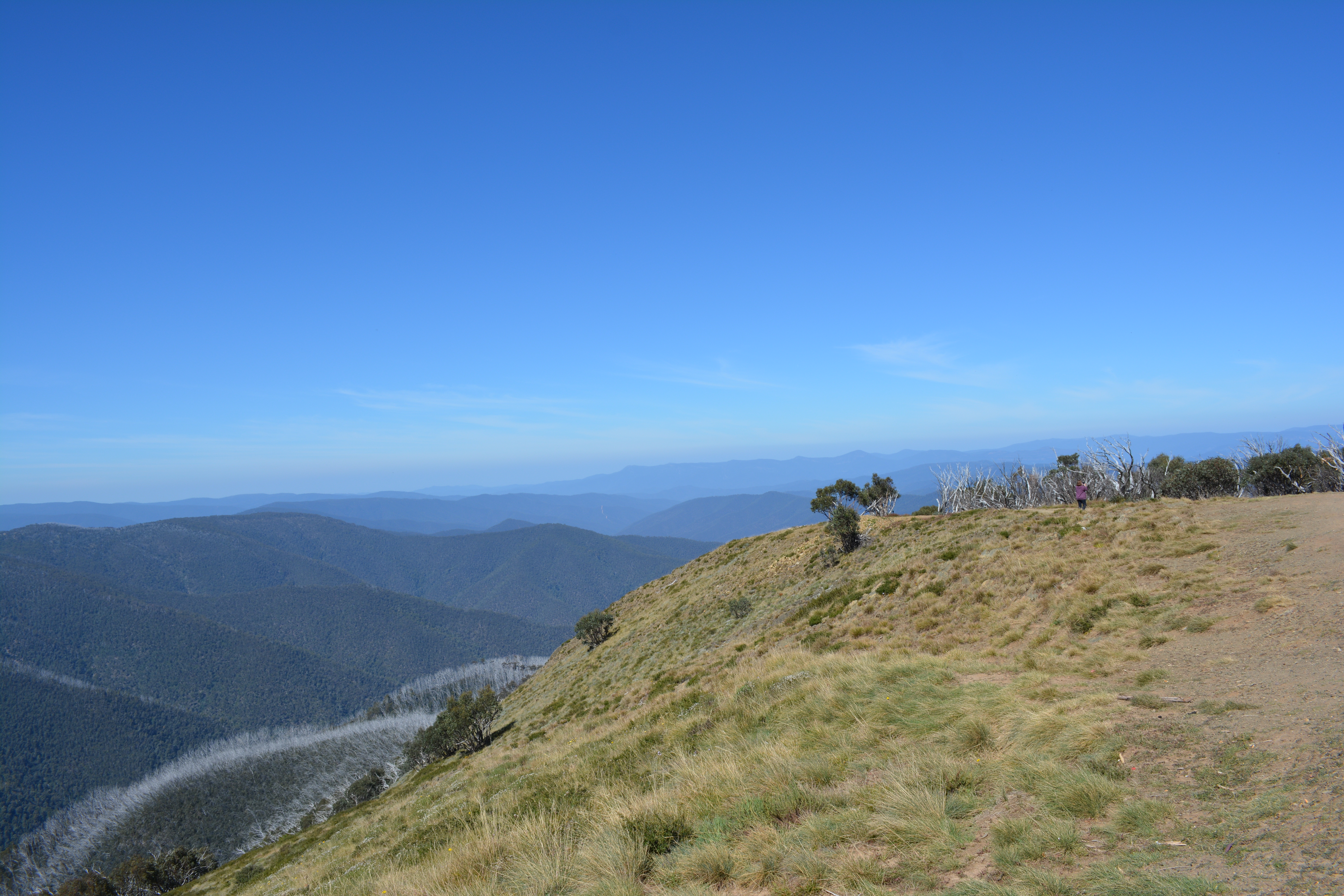
The weather was perfect with clear blue skies and almost no wind. The track was dry, so the drive in was straight forward if bumpy. Blue Rag Range track is definitely only for 4WD cars with good clearance. The track passes near to Mt Blue Rag and proceeds right over the peak of Blue Rag Range.
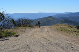
Hence this activation requires an obligatory walk down the hill and back up into the activation zone.

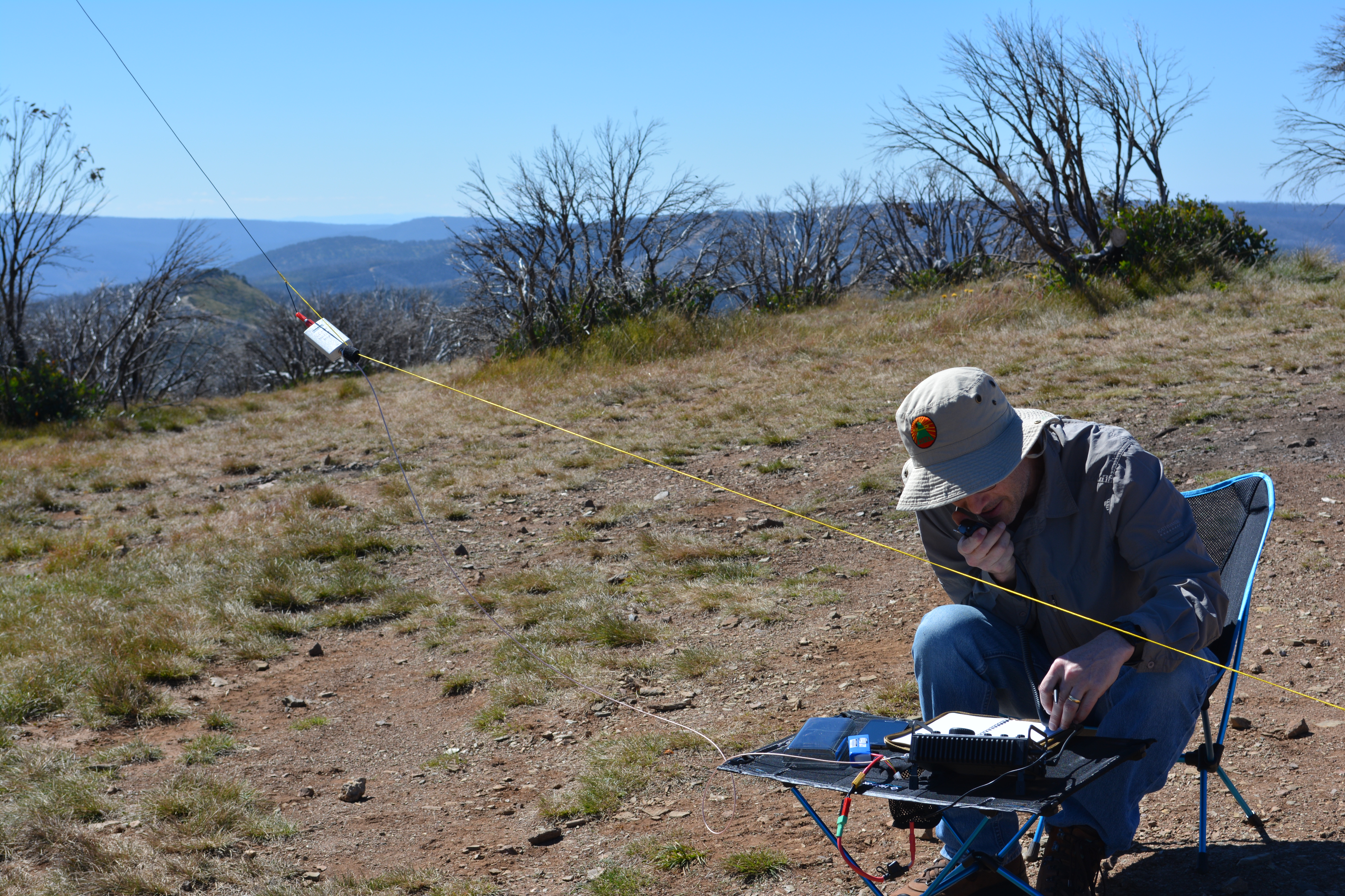
My daughter helping set up the operating position
Once back, I had some help from my daughter setting up my operating position.
A quick spot on RRT (line of sight to the mobile base station on the top of Mt Hotham) soon had a small pileup under way.
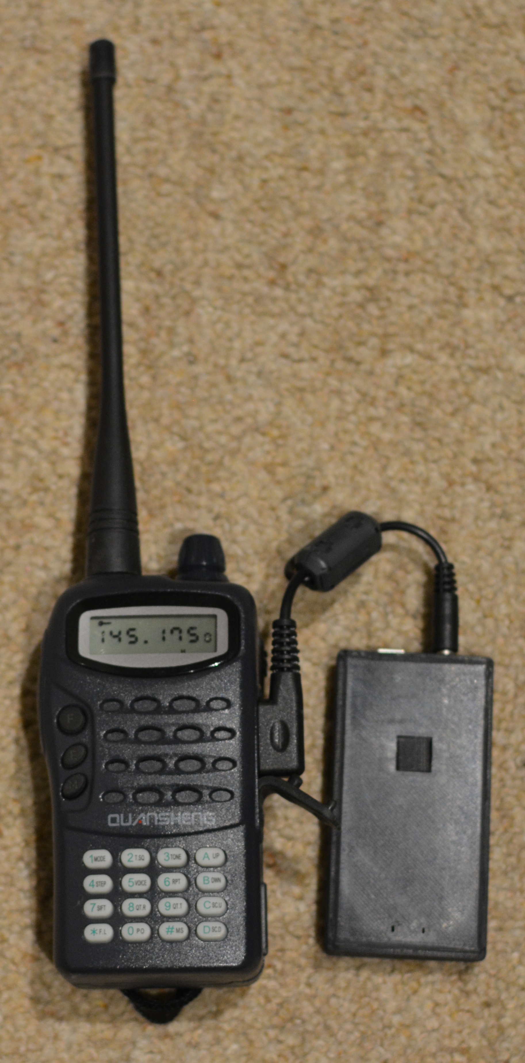
MobilinkD TNC and Quansheng 2m HT
In fact Peter VK3PF found me before the spot appeared as he’d been watching my progress on APRS.
I recently bought a MobilinkD TNC
which connects a 2m HT to your Android phone via BlueTooth and works with APRSDroid to beacon your position to the APRS network. I have a cheap Quansheng 2m HT which works fine for this purpose.
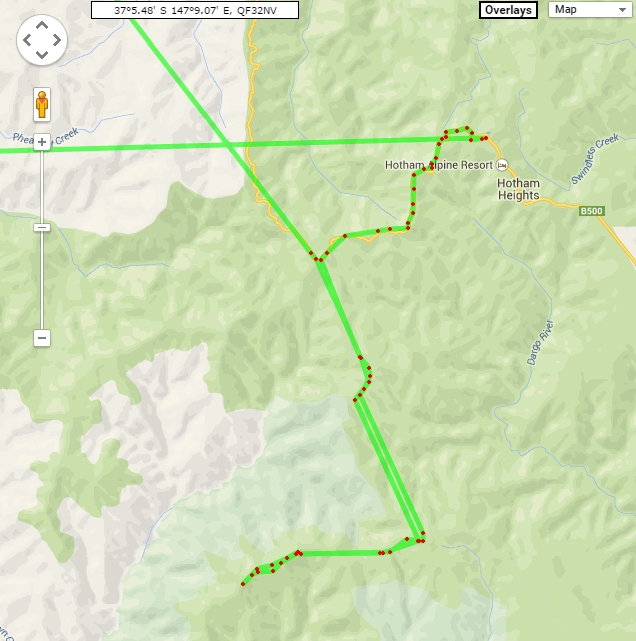
APRS track from https://aprs.fi
It is interesting to look at the coverage map as my position was plotted from Mt Hotham to Blue Rag Range. I was using the 5W HT with a roof mounted 2m/70cm mag mount antenna – not optimal, but OK. I think my next car will have to get a APRS enabled mobile rig installed!
At the higher elevations, the coverage is quite good, but certainly patchy down lower. Maybe we should put an APRS digipeater on the top of Mt Hotham to help with SOTA activations?
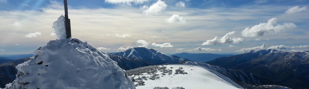
My new SOTA hat keeping the sun off
This activation was done with my KX3 and simple multi-band EFHW antenna. I was thinking of trying some other bands, but patience of the family was wearing thin after working the 20 callers (including two S2S), so I thought better of it!
As you can see from the photos, the weather was perfect and the views spectacular.
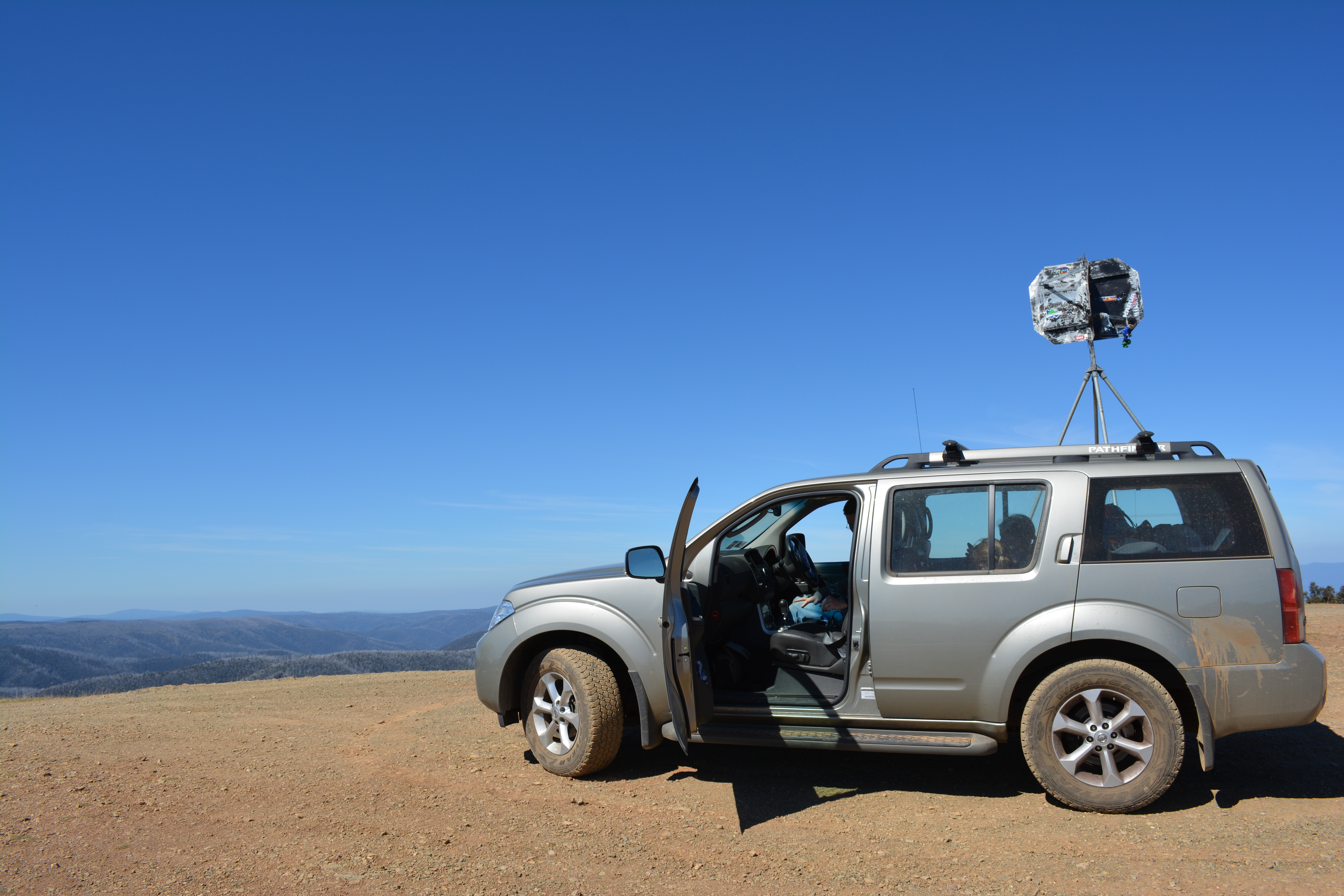
The car didn’t even get very dirty!
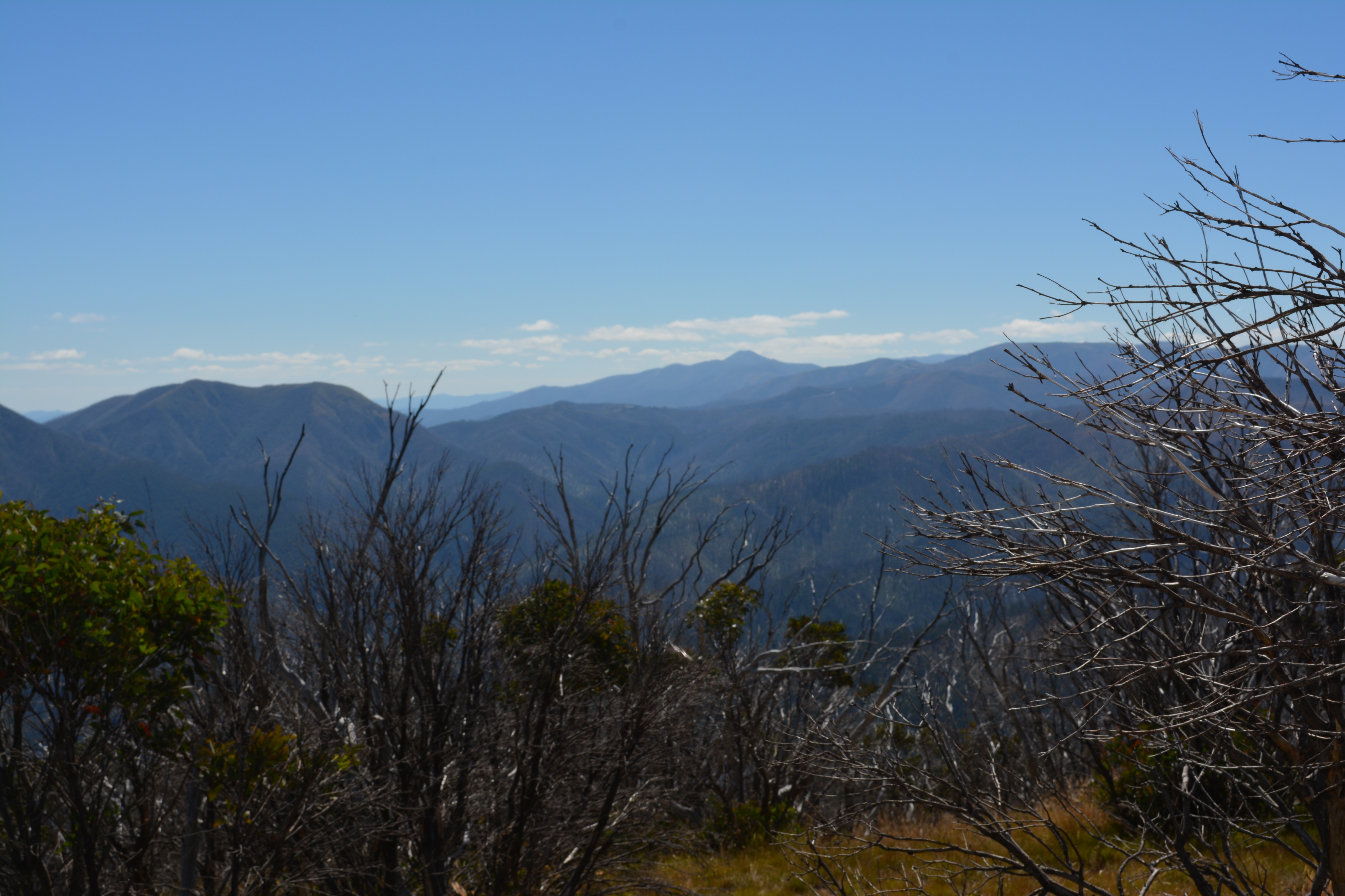
Mt Feathertop in the distance
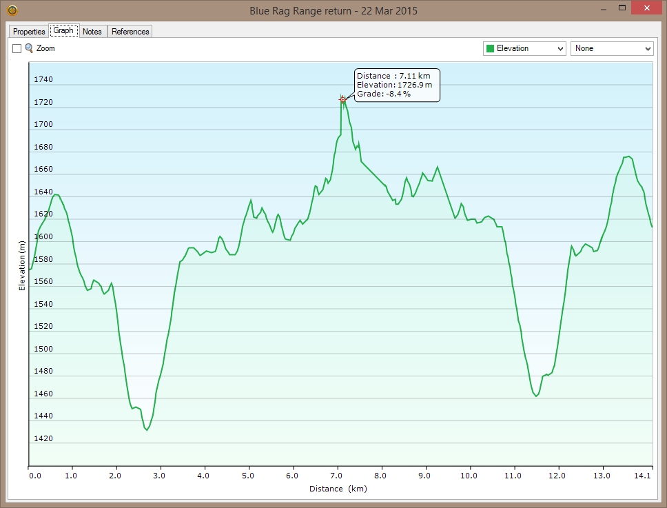
Here’s the trip stats for the drive along the Blue Rag Range track for anyone wanting to plan this activation. Note that I’m still a novice 4WDer!
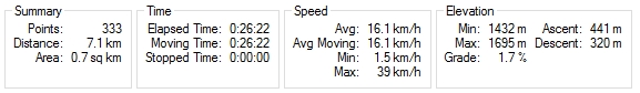
Outbound to Blue Rag Range
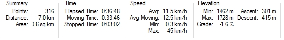
Return to Dargo Rd