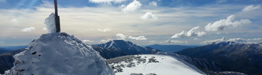
The view from near the top of Blue Hill
The end of the winter bonus period was upon us and I was determined to get a few more 13 point summits this year. I had been eyeing off a few unactivated summits in East Gippsland and managed to get a leave pass for a whole weekend for the last weekend before summer rules applied. I had read Peter VK3PF’s blog on this area when he visited last year and decided to tackle a few of the summits he mentioned. The initial plan was Mt Seldom Seen on the Fri night on the way up, three summits on Sat and three or four summits on Sun leading to a possible 109 points for the weekend. The reality was 950km driving for just 3 summits qualified and 35 points!
I left home at 3:00 pm on Fri afternoon with a plan to drive to Mt Seldom Seen via Buchan and activate it in the evening. From there continue on to Native Dog Flat camping ground in the Alpine National Park for the night.
The trip down the LaTrobe valley was straight forward and saw me getting to Buchan around sunset – it’s a beautiful valley, so I was glad to have some light to see it. From there I headed north to Brumby and the Mt Seldom Seen road junction. It was fully dark by the time I got to this road and headed into the bush. The track was in quite good condition, but had some significant water furrows across it in places that would have made it difficult in a 2WD (I was driving a Nissan Pathfinder 4WD which was fine).
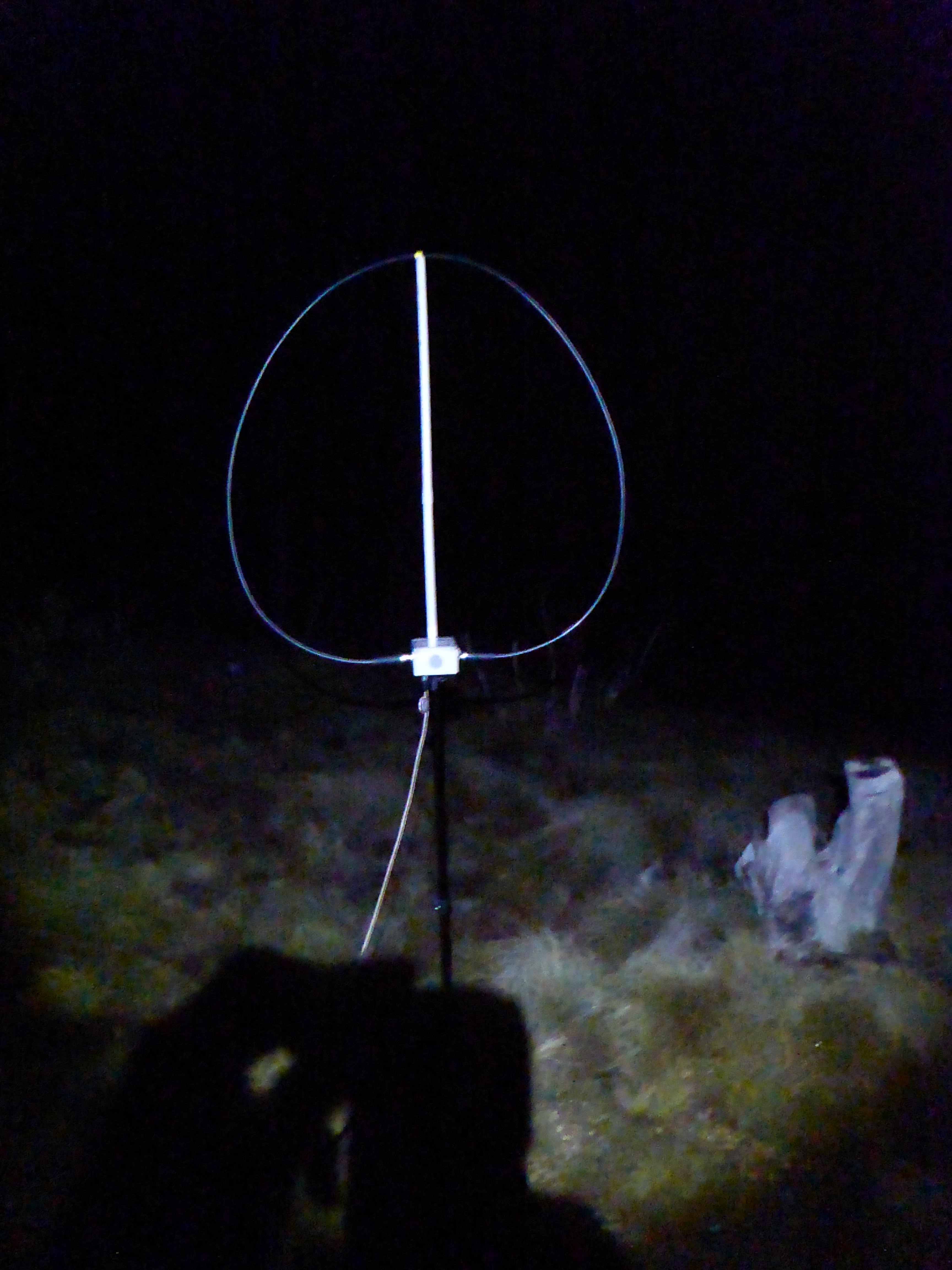
My magnetic loop on Mt Seldom Seen
I arrived at the clearing on the summit near the communications installation and parked. I was hoping to make this a quick activation given the time of the night, so set up my magnetic loop antenna and the KX3 and started listening. There were plenty of strong overseas stations on 40m, but they would have been very unlikely to hear me on 10W. I managed to find a clear frequency and placed a spot. I called for quite a while, but had no takers. I tried on 20m and similarly no contacts. At this point I decided I’d better get out my EFHW, so spent another 10 minutes setting that up. Again I called on 40m and 20m to no response – rather discouraging.
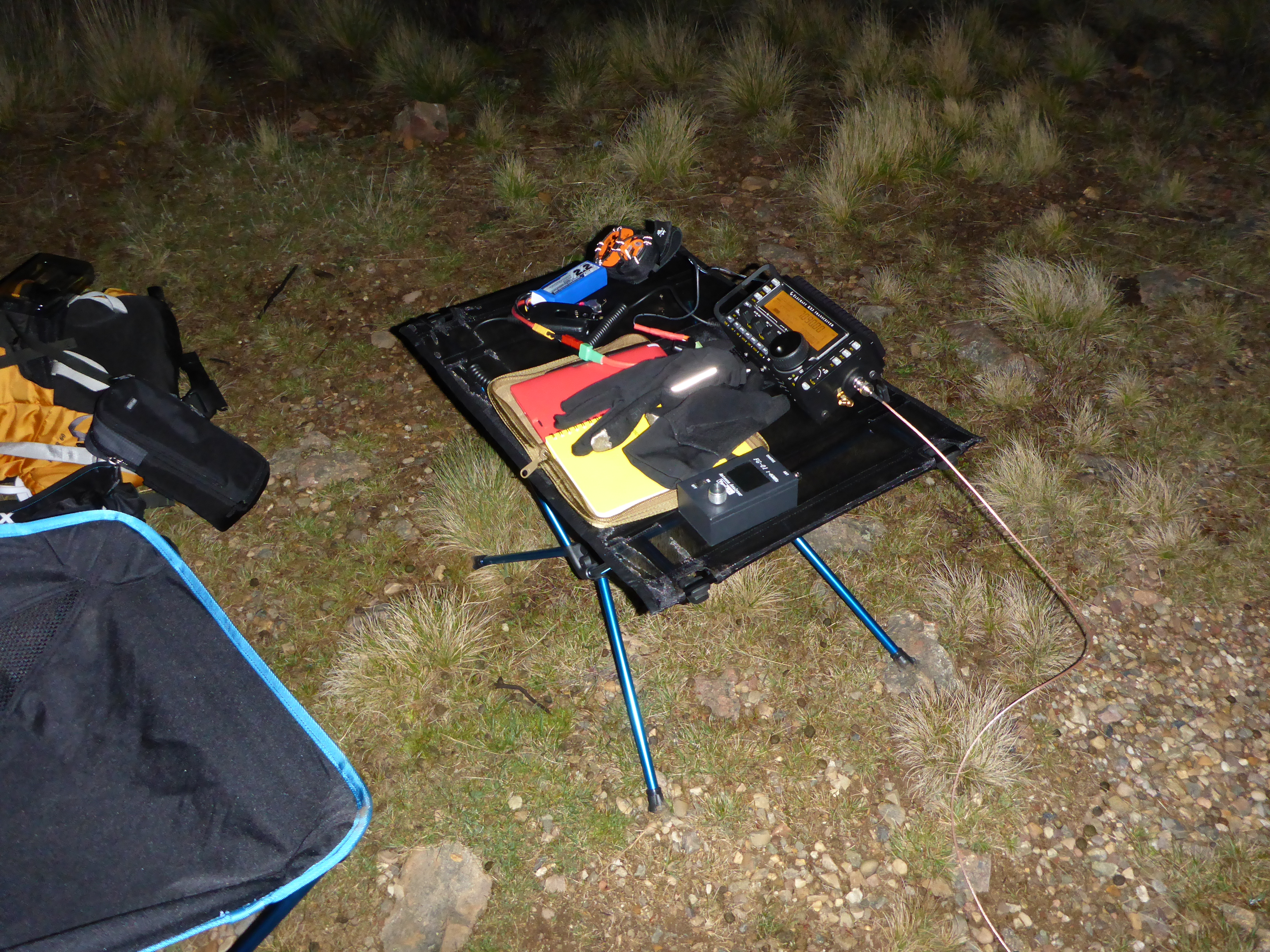
Operating in comfort at Mt Seldom Seen
Even though my EFHW is for 40m and up, I found I could actually get the KX3 ATU to tune it up on 80m! No doubt highly inefficient, but I could get some signal out. I spotted and was rewarded after some calling with Tony VK3CAT hearing me and giving me a 36 report while he was 55 to me. However, that was it – nothing further after many calls. It was almost 10:00pm by this time and I still had some driving to do to get to the campsite, so I gave up and counted it as activated, but not qualified. I’m now working on a 80m extension to my EFHW to make sure I can get a decent signal out on that band.
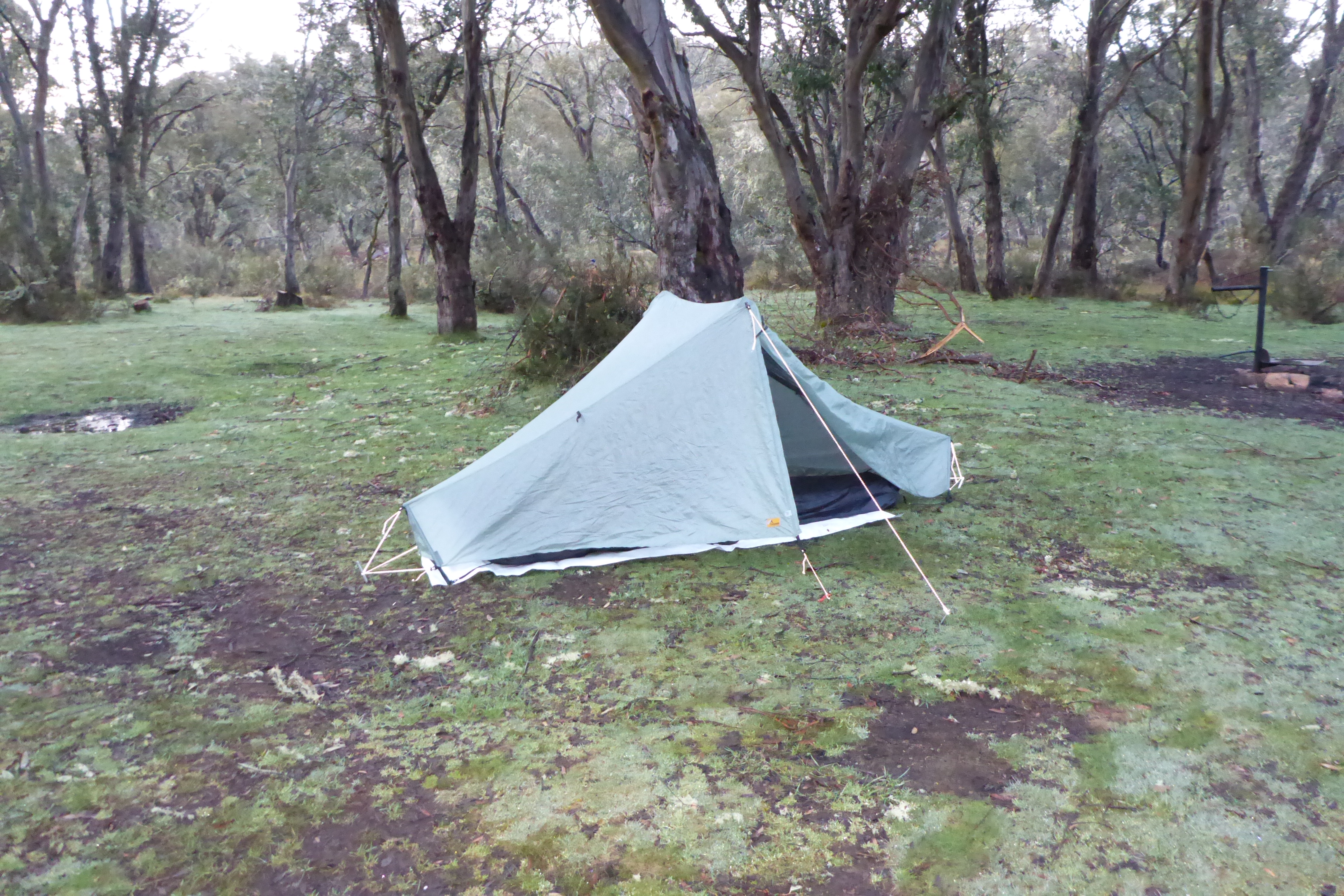
My tent at Native Dog Flat campsite
I drove on to Native Dog Flat campsite and set up my tent finally crashing into bed at midnight. Native Dog Flat campground is a great but basic National Parks maintained site in the middle of the Alpine National Park. It sits in a valley at 1400m altitude near the headwaters of the Buchan river surrounded by dense forest. It is accessed by Limestone Rd which connects the Buchan valley to the Omeo valley through the Alpine National Park (this road is subject to snow in winter and carrying chains is mandatory during that period.)
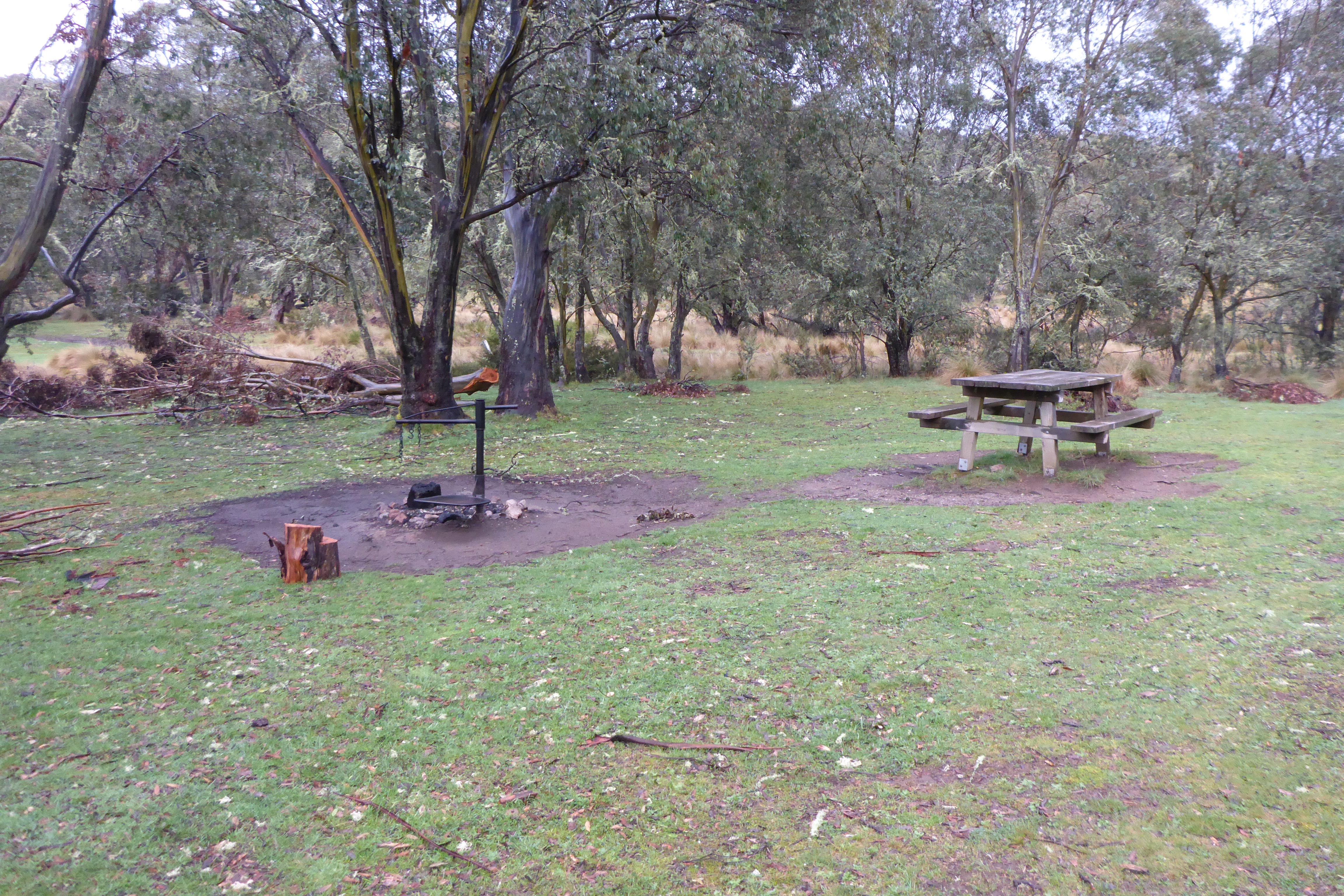
Well maintained facilities at the campsite
The campsite has plenty of room for cars and tents and has fireplaces and a picnic table together with a remarkably civilized toilet for the location. The area is known for brumbys which regularly come to feed on grass flats near the river in the evenings.
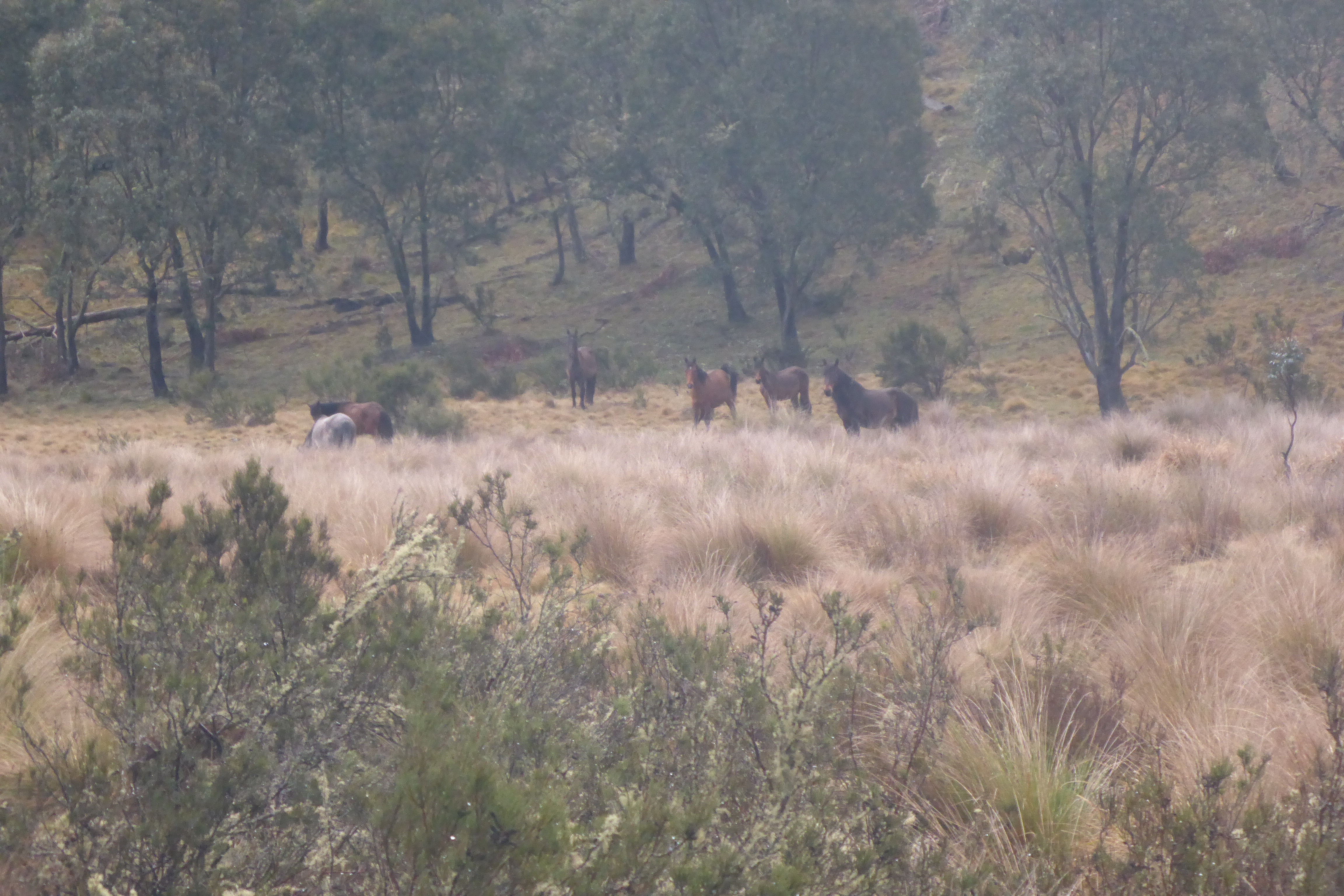
Brumbys grazing near the campsite
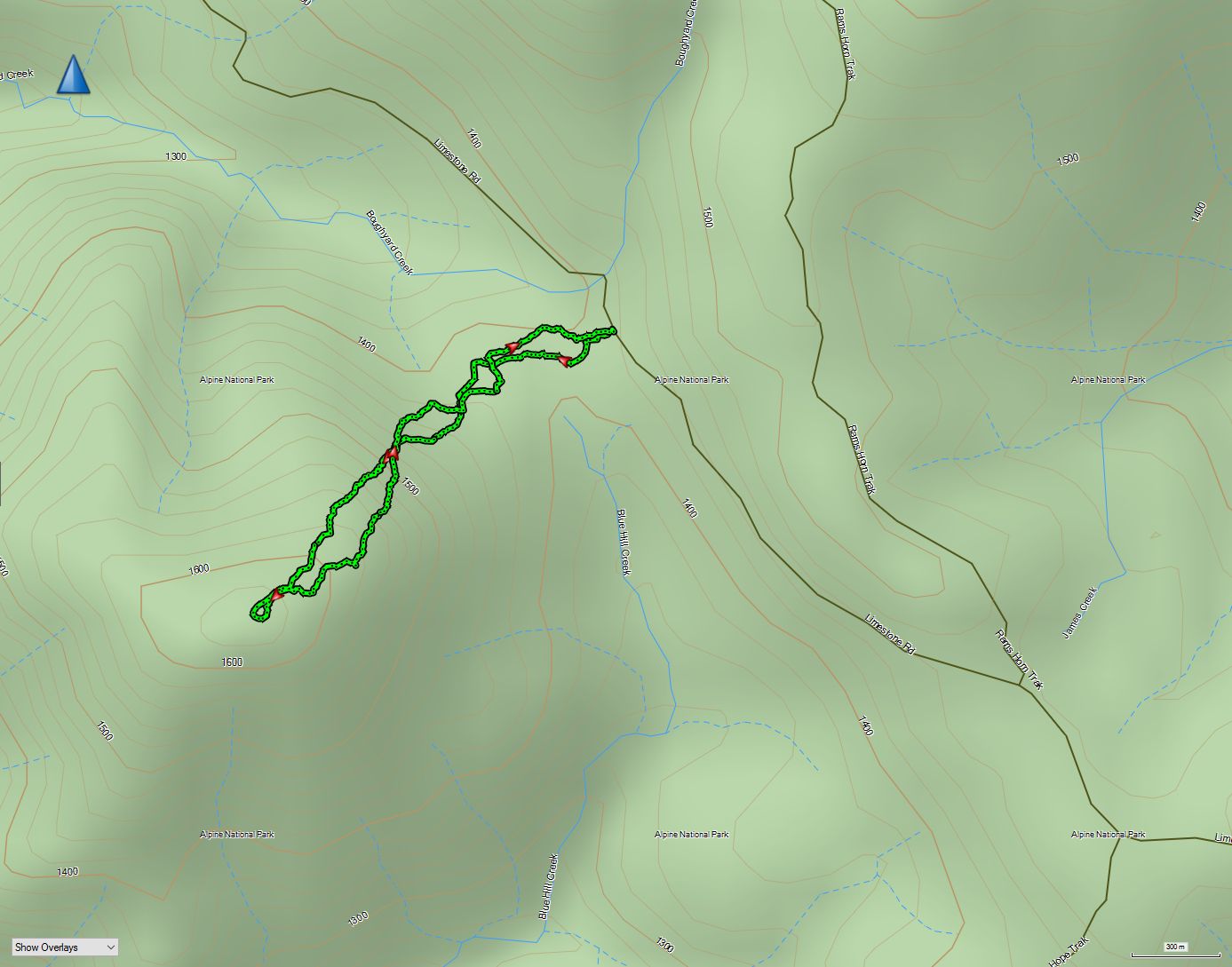
I was woken by the light at 6:30 on Sat morning to three degrees air temperature – my sleeping bag was only just up to it – I was a little cool and so wasted no time in getting moving. I ate breakfast, packed up the camp and drove back along the road to the best looking approach to Blue Hill, my first target for the day. This is a 10 point summit that had not yet been activated, so was my first priority.
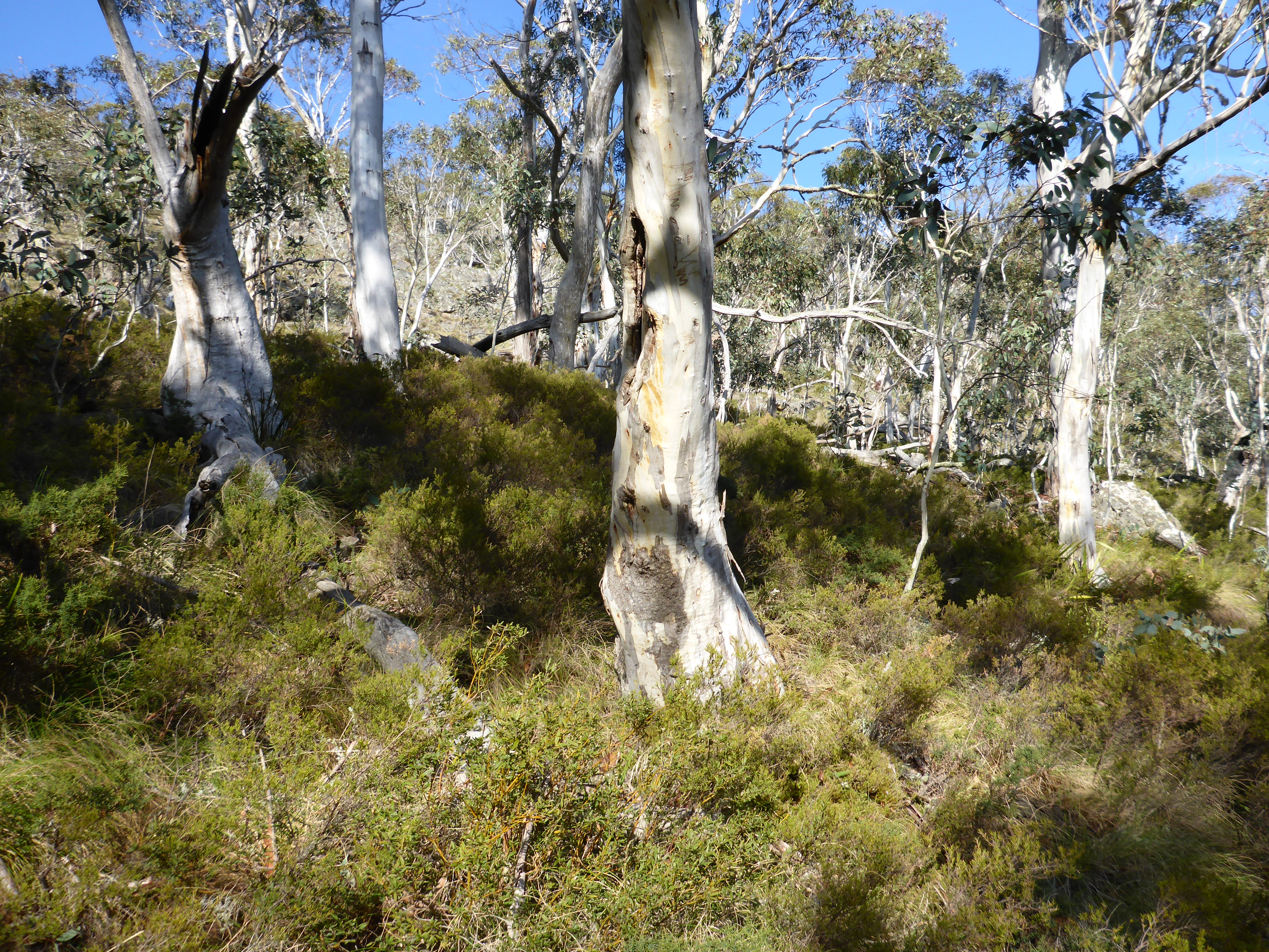
The undergrowth is dense with many spiky bushes
There are no tracks here, just dense bush with many brumby tracks cris-crossing it. Looking at the terrain on the map, I picked a path that looked to have the thinnest bush and not too steep an ascent and plunged in with my 12 kg pack (a bit of redundancy in radio gear plus safety gear given this is still the alps).
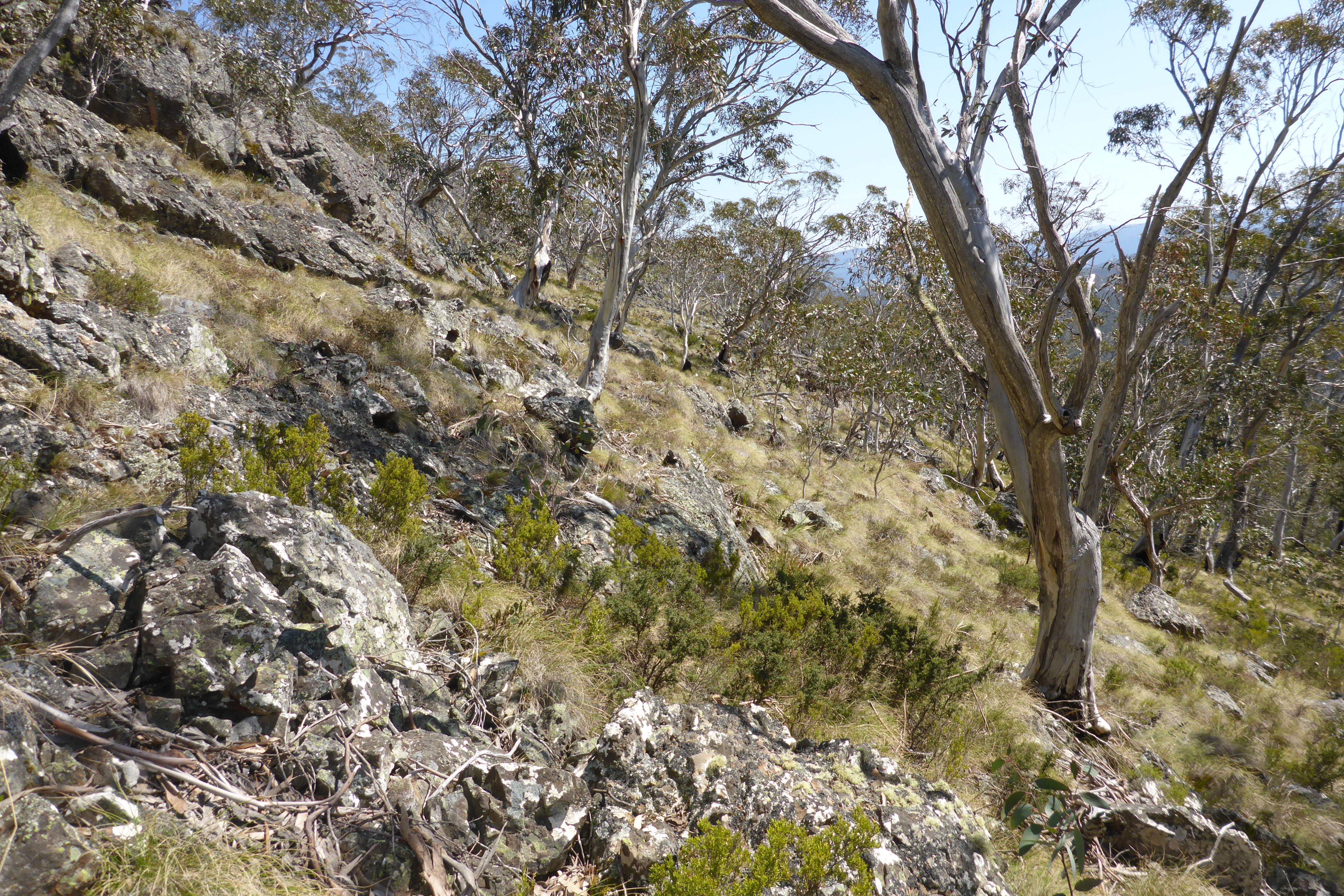
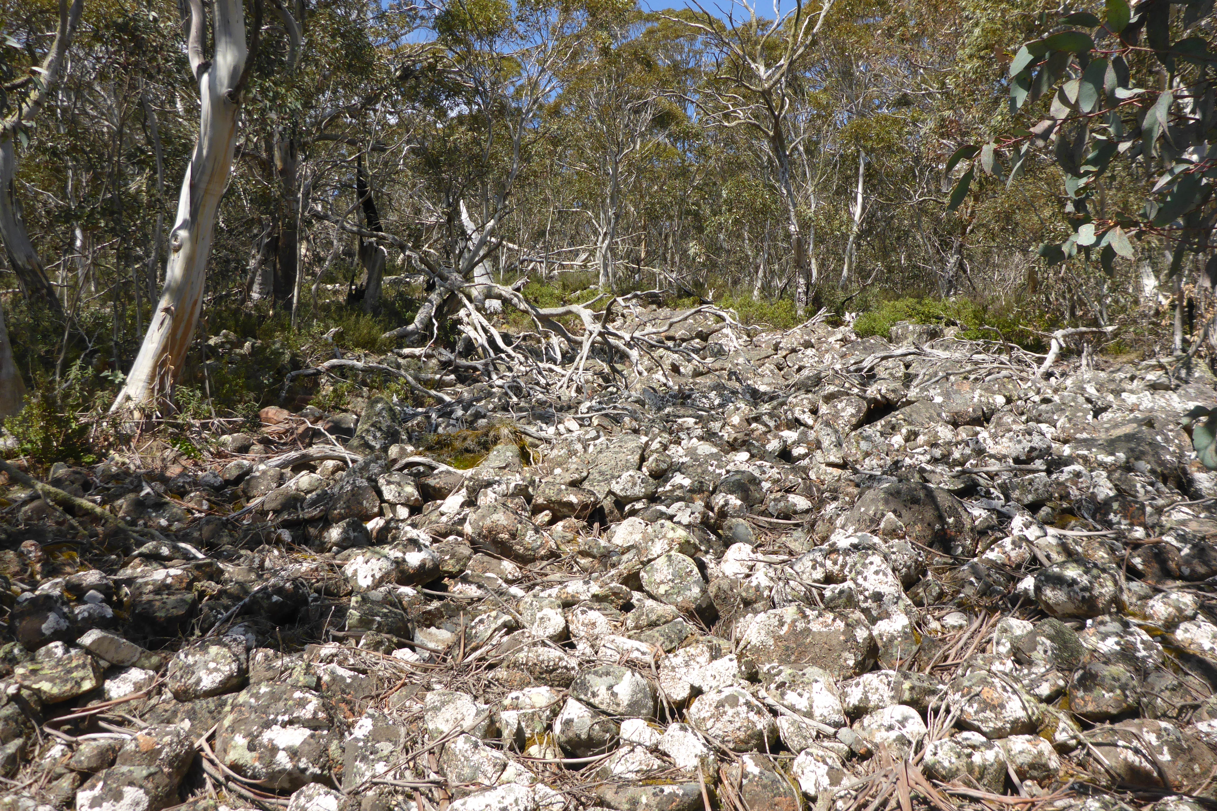
Parts of the ascent were quite rocky
The going was slow with the need to pick a path through constantly changing bush, moving around fallen trees and rocky outcrops. I followed brumby tracks some of the time, but they invariably strayed from my intended route. Whilst I didn’t see any brumbys on this hike, evidence of their passing was everywhere with dung piles strewn throughout the bush.
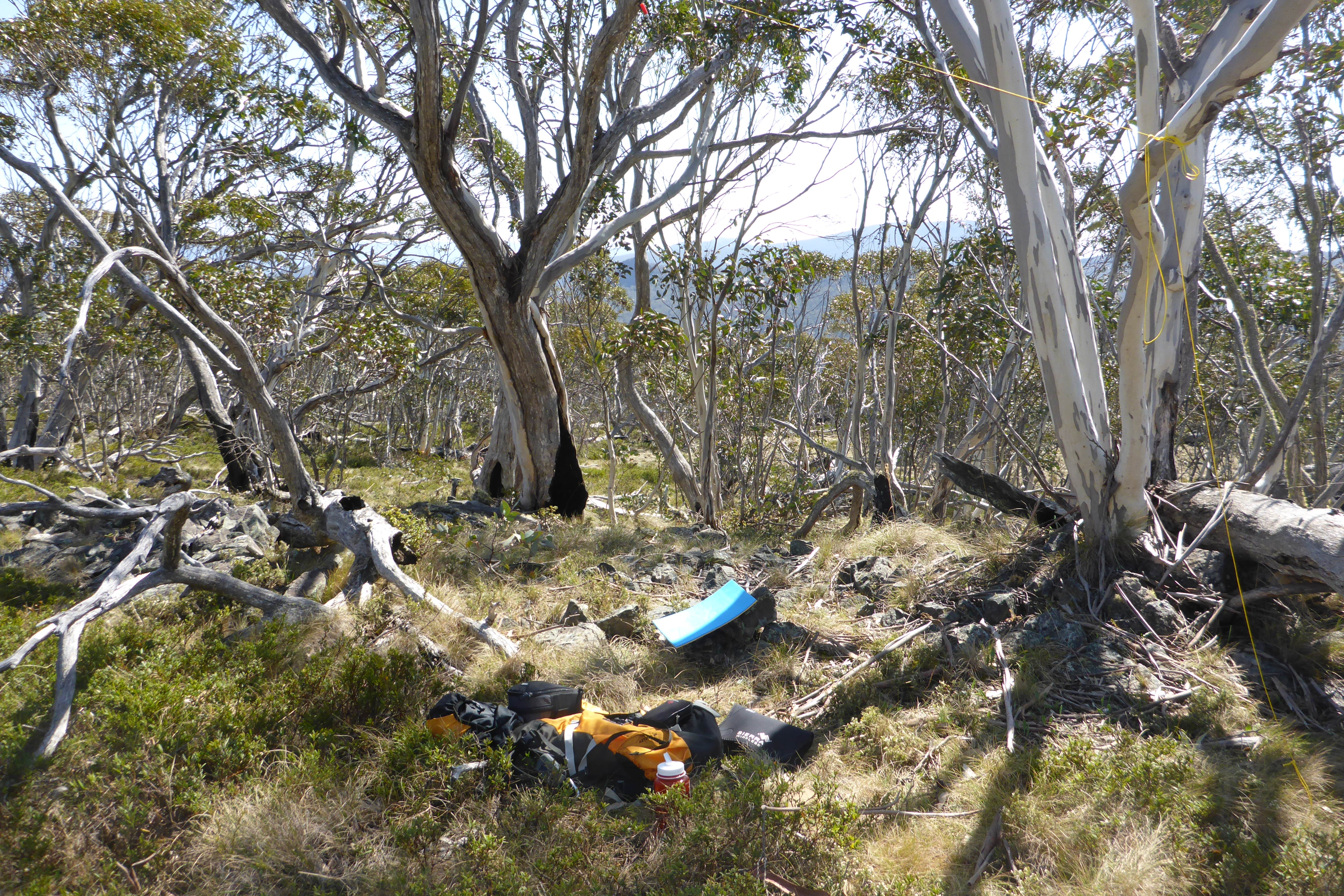
The operating position
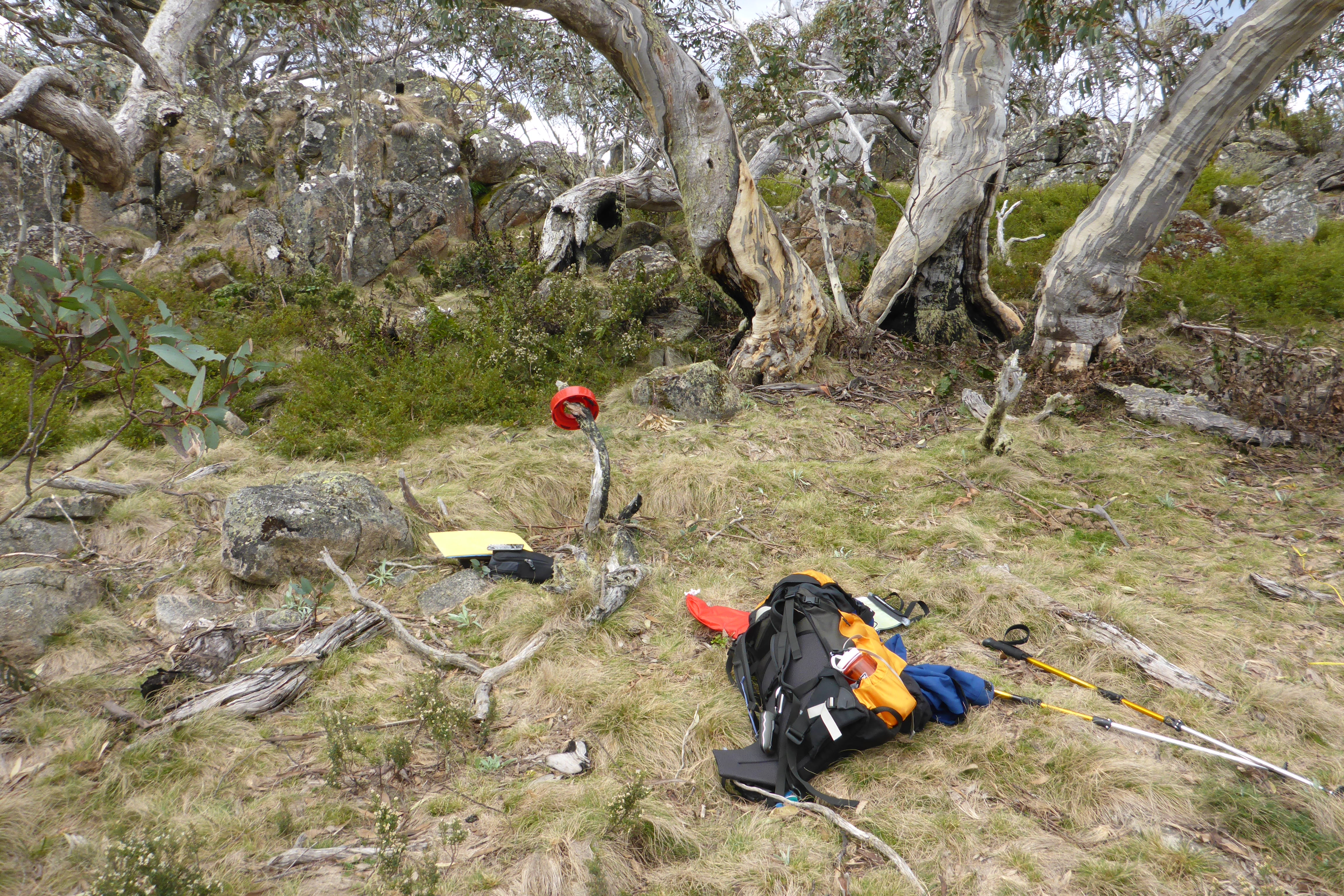
The walk was only 2 km, but took 55 mins to reach the summit. The summit itself is fairly broad and flat and the bush is fairly open here, so there was plenty of room to string antennas. I set up my EFHW and KX3 and sat on a comfortable rock.
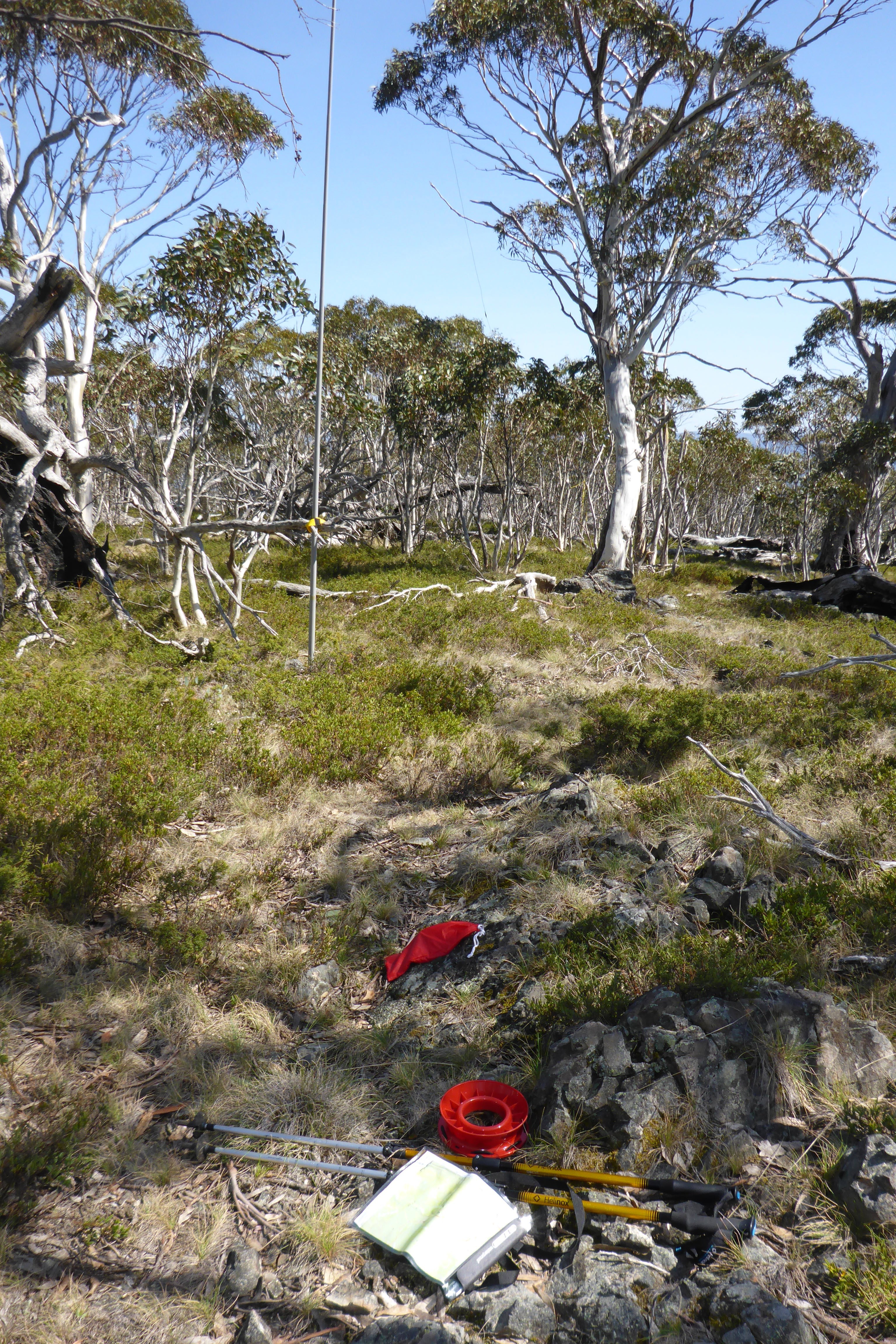
Plenty of room for antennas here
There is no mobile coverage up here, so I knew that spotting was going to have to rely on chasers. I started calling on 7090 around 9:40 am and after about 10 mins managed to contact Steve VK7CW who kindly spotted me. Soon after I heard Tom VK5EE and after that, nothing. After a further 20 mins, many calls and trying 20m too with no further calls, I made the intrepid decision to break out the paddle and try CW for the first time from a summit – I clearly wasn’t going to get a pileup today, so I figured I could probably manage a few CW contacts.
I called on 7032 and a few CQs later worked Phil VK2FGBR in Newcastle. Continuing with the CQs I had plenty of sending practice! I had read about the new national 40m CW calling frequency on 7050, so decided to give that a try. After a couple of calls, Michael VK2CCW came back to me and completed my 4th contact after more than an hour of calling – that was hard work, but I qualified it and locked in the first activation of Blue Hill.
I was now well behind schedule, so packed up and headed back down the hill. This time it was 50 mins, so not much quicker given the rough country. One point about this hill is that there are many very spiky bushes to push past, so gaiters are mandatory. Despite having these, my knees felt like pin cushions by the time I returned to the car!
Some very attractive sections on this walk
I drove on to Mt Wombargo, the second target for the day, and had a quick lunch at the car to save carrying it up the mountain. I set off across Square Flat, an open somewhat marshy grassland. and headed up the hill. Soon after starting I startled a large stag deer with an impressive set of antlers, but unfortunately he left before I could get the camera out.
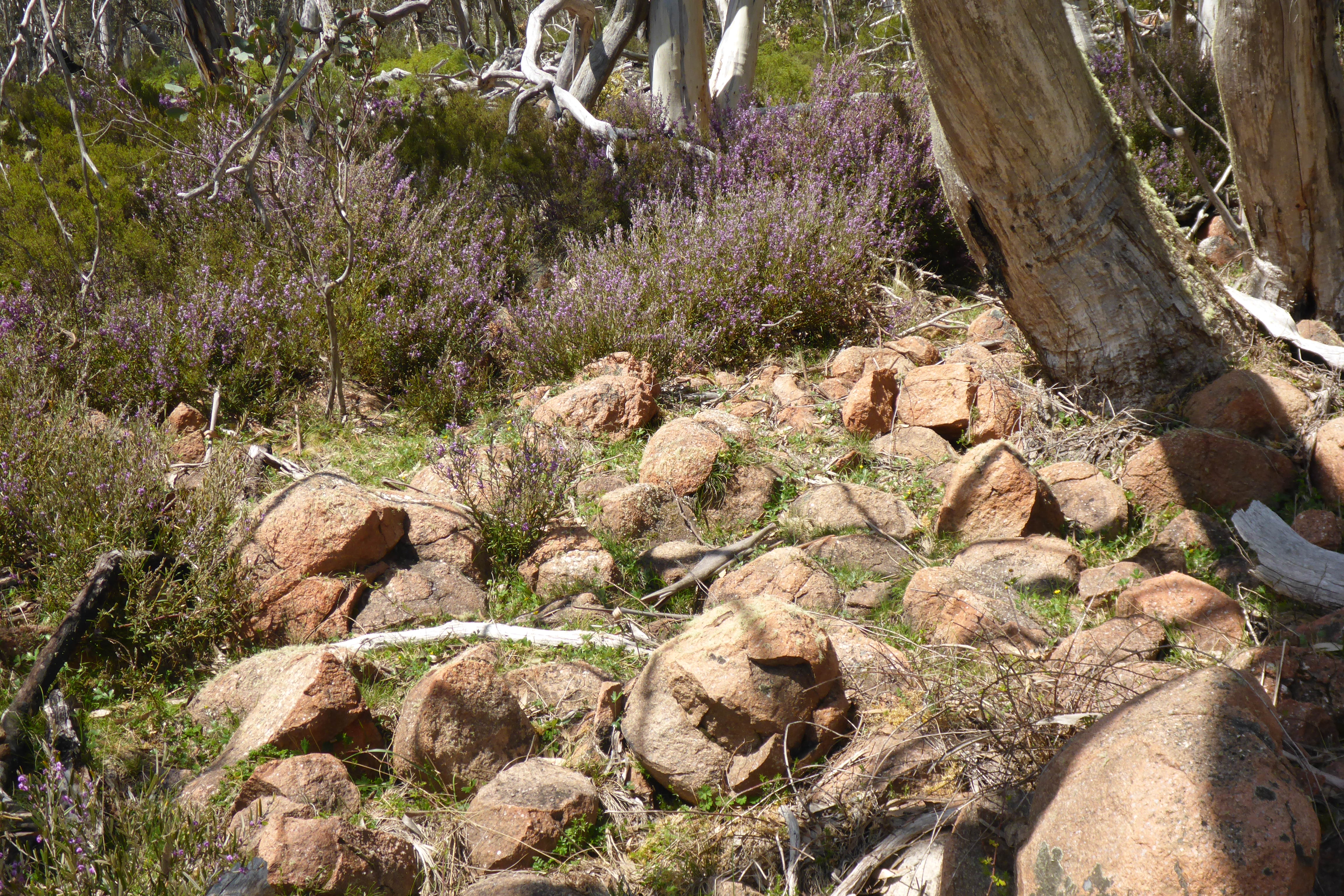
There were several section like this to negotiate
The walking up here was easier than Blue Hill, but there were some big rock fall areas to negotiate and plenty of fallen trees to find paths around. The hike is slightly longer than Blue Hill, but took around the same time going up, but much quicker coming down.
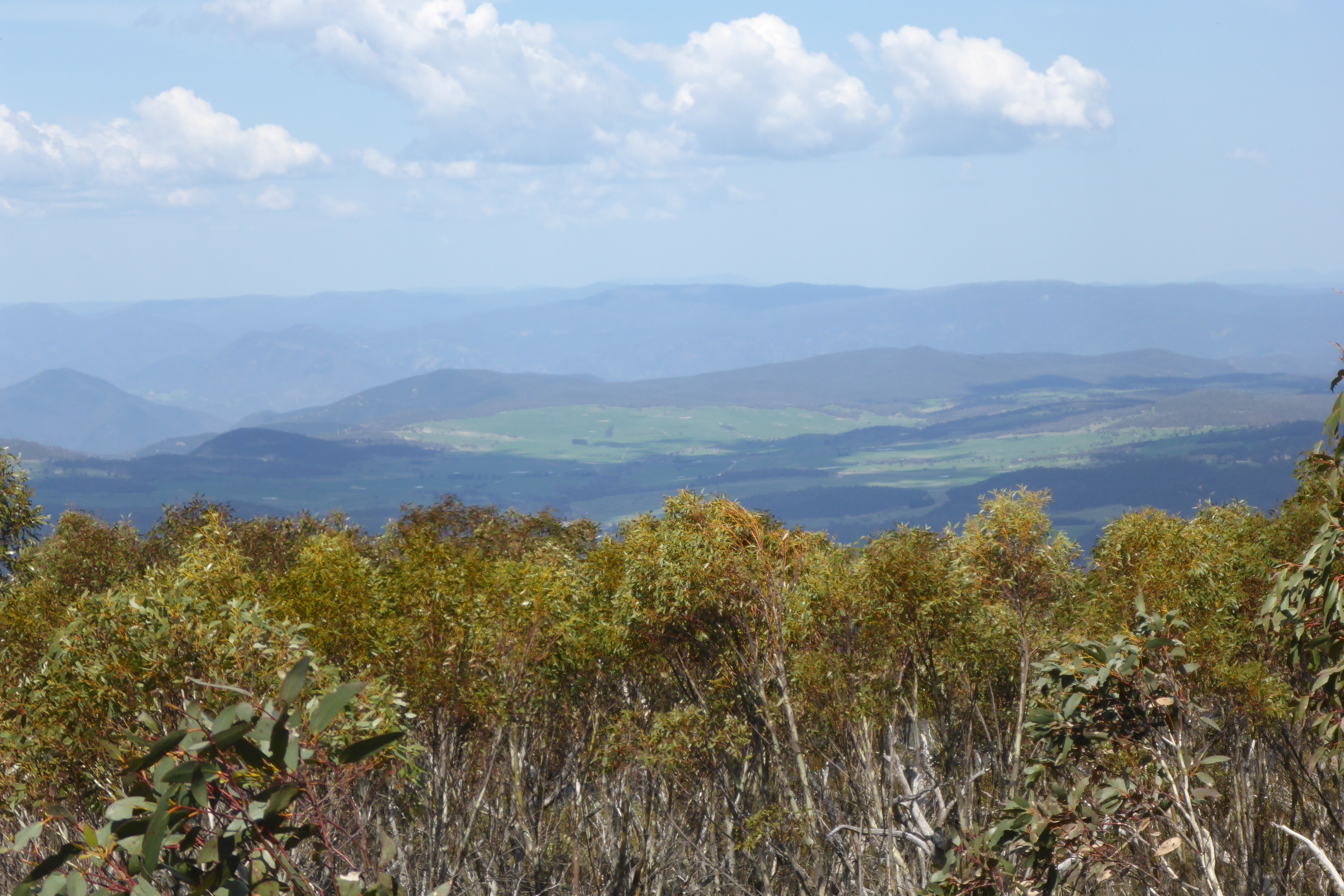
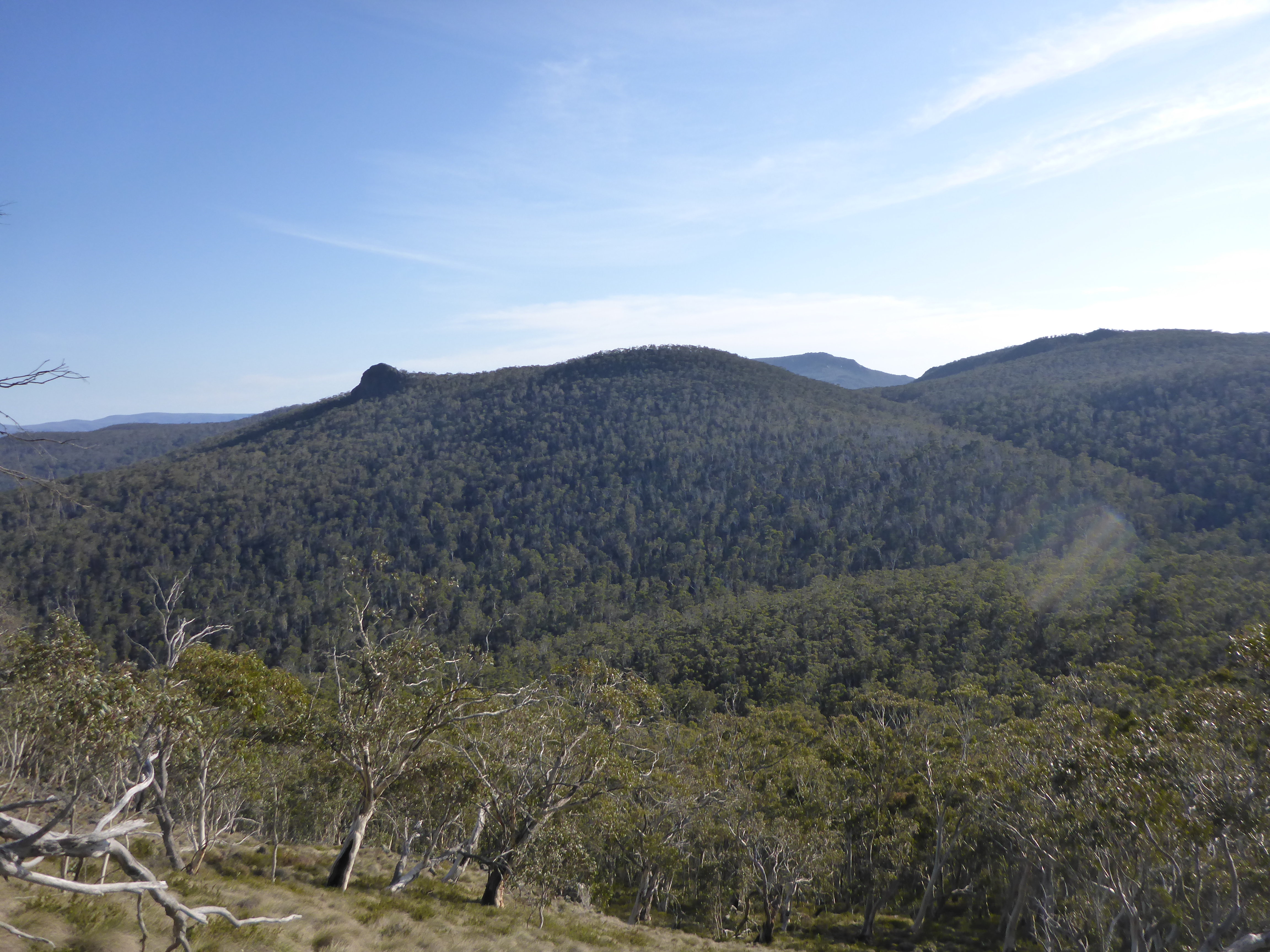
There were some great views to the south east from the top
I set up my EFHW at the top – there were plenty of dead trees to attach the squid pole to, and the forest was open enough to make it easy enough to erect the antenna. The challenge was finding somewhere to sit that was not covered in ants!
The operating spot – a good spot apart from the ants!
The moment I switched on the rig, I new I was in trouble – S9+ lightning crashes across all the lower HF bands! I could hear the rumble of thunder to the north, so I knew I wouldn’t have long despite it being relatively clear in the immediate vicinity. I could hear no stations at all on 40m, just loud static crashes. I called for a while on 7090, but heard nothing. I tried 20m for the same result. I then called CQ on CW on 7032 and also had no replies. After half an hour the rumble of thunder got louder and the clouds were building, so I decided to pull the pin and get off the mountain before a thunderstorm arrived. Hence zero contacts and a failed activation.
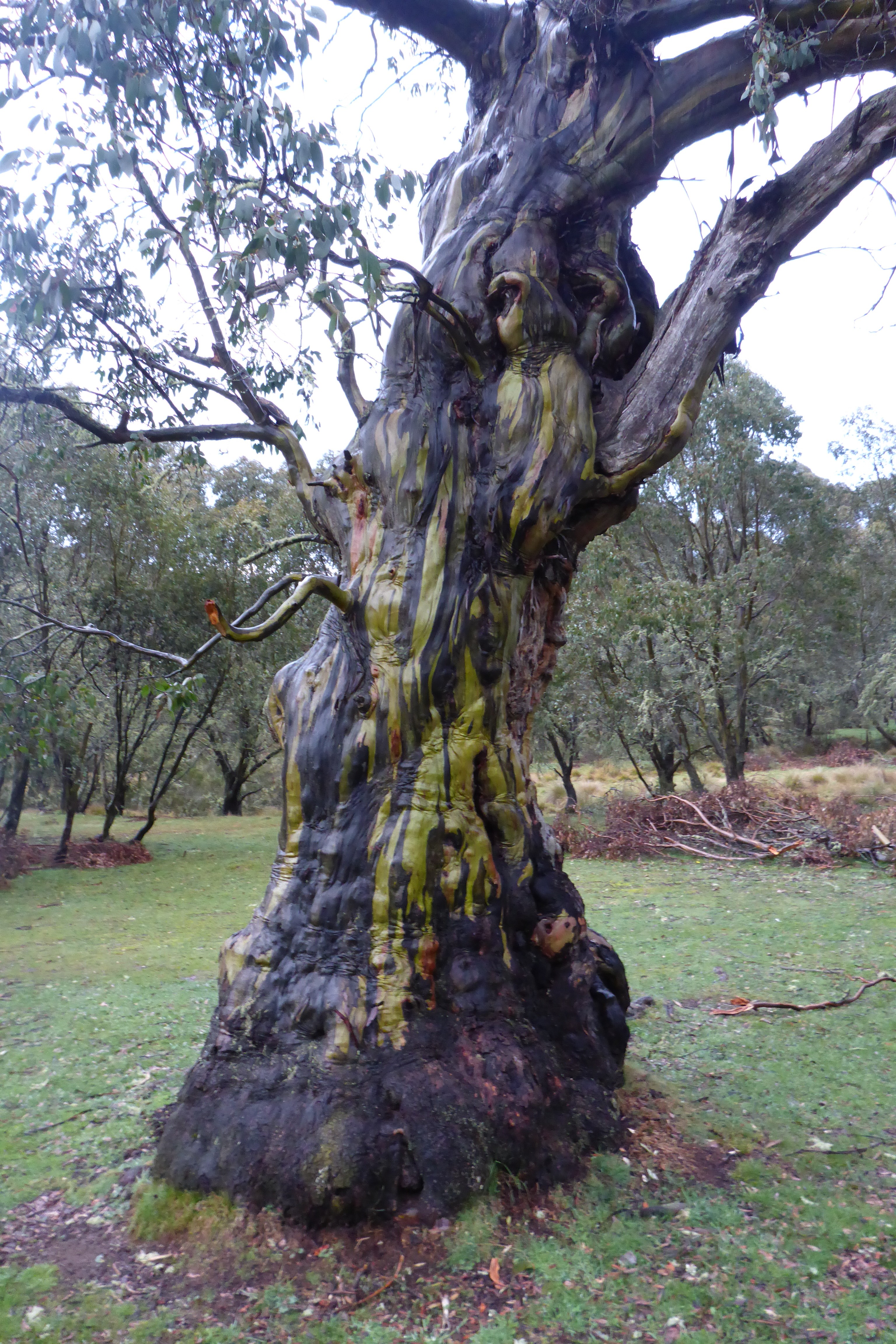
A rather attractive tree after the rain at the campground
On the way down, there was some light rain, but no thunderstorms materialized to my relief. Back at the car, it was now 4:00 pm and I was tired after 4 hours of bush bashing. With the storms nearby and wall-to-wall lightning static, I knew there was no point in trying to do any more summits, so I headed back to Native Dog Flat for the second night.
Thankfully, the rain held off until I’d set up my tent, but I did get to cook under the shelter of my tailgate as the rain came steadily down. It cleared after a time and had stopped by the time I went to bed. It did however rain from about 3:00 am until dawn, so everything was rather wet to pack up.
Continued in the next post…
Here are some statistics for the two hikes for those wanting to attempt them:
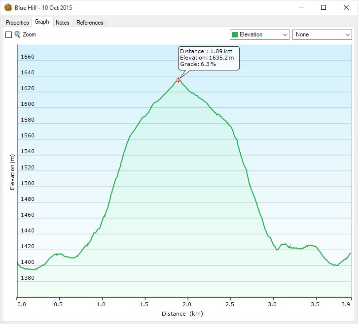
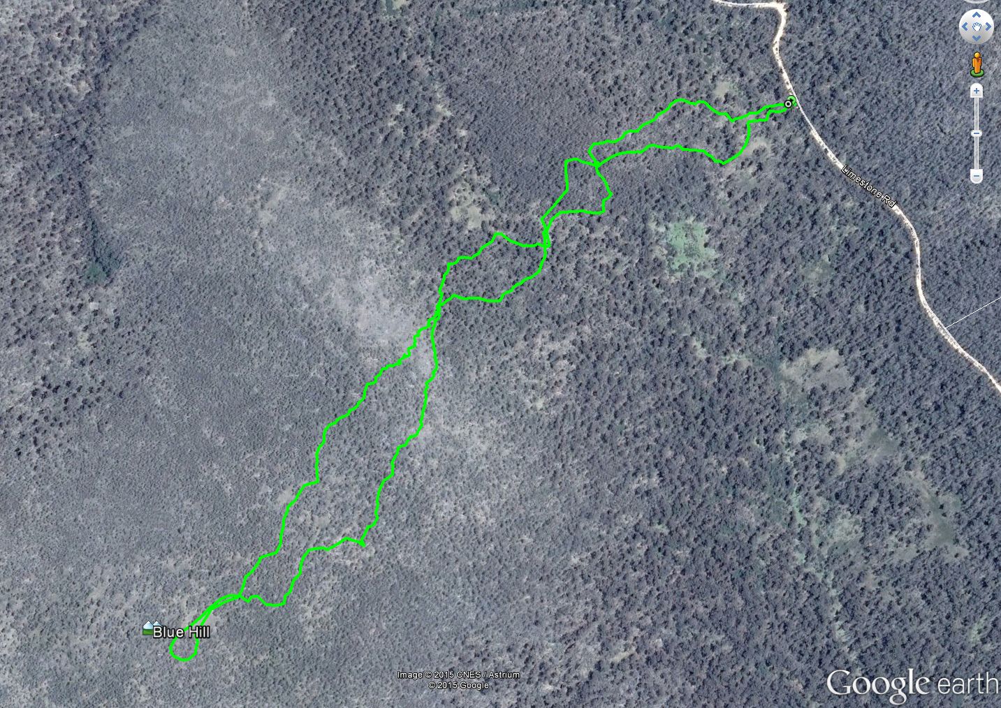
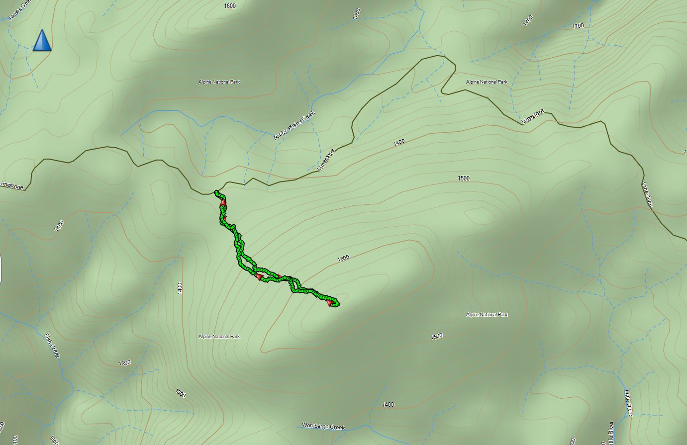
Blue Hill
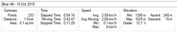
Blue Hill outbound
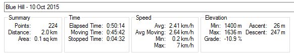
Blue Hill return
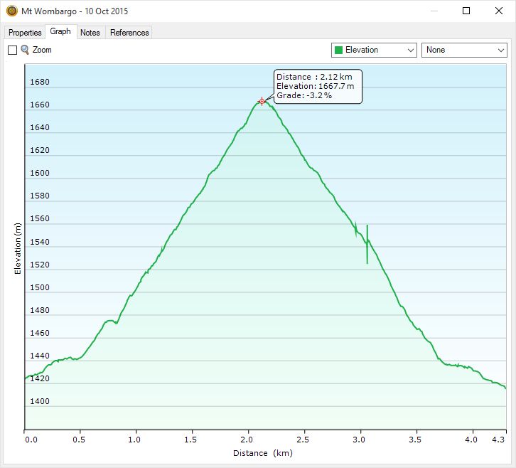
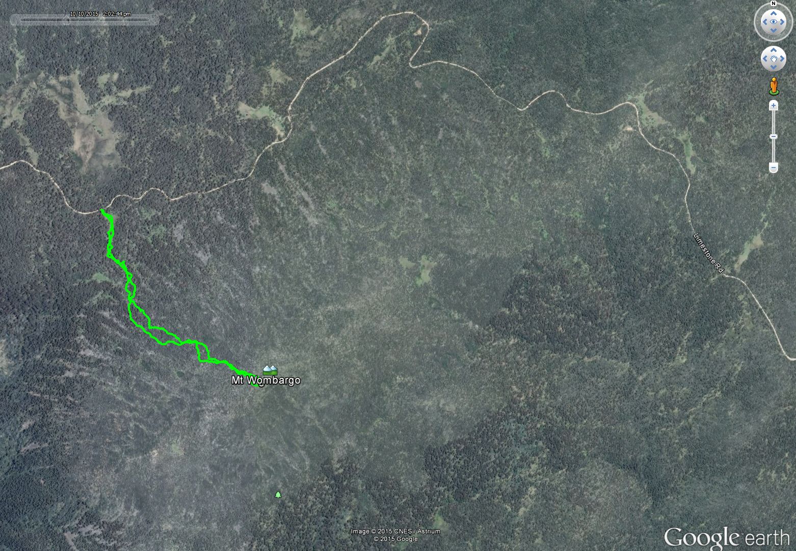
Mt Wombargo
Mt Wombargo outbound
Mt Wombargo return
Great post David, a bit of a different challenge to snow and ice covered summits. It looks as if 40 meters cannot be relied upon as a viable band during the day or night, so diversifying into CW and 80 meters is the right strategy.
Thanks Paul. Yes, flexibility looks like it will become more and more important in the years to come.
Hi David, I admire your stamina and enjoyed reading the post. Well done on taking up the paddles on 7.032 and 7.050.
Cheers
John D
VK5BJE
Thanks John. I’ll try and use the paddles a bit more in the future – I may have to if conditions continue as at present!
Pingback: East Gippsland Day 2 - 11 October 2015 - VK3IL BlogVK3IL Blog