The Razor and The Viking in the early morning mist (Photo: Glenn)
Glenn VK3YY and Allen VK3ARH were keen to get to some remote areas of the Southern Alpine National Park before the winter road closures made access too difficult. I too was keen to get back there and so a plan was formed and a weekend with an outstanding weather forecast for the time of the year presented itself. We chose to take my car due to its 4WD capability (which wasn’t really needed in the end).
The aim was to tackle five 10-point summits over the weekend with some decent hikes included. We managed four of the five and had a fabulous weekend.
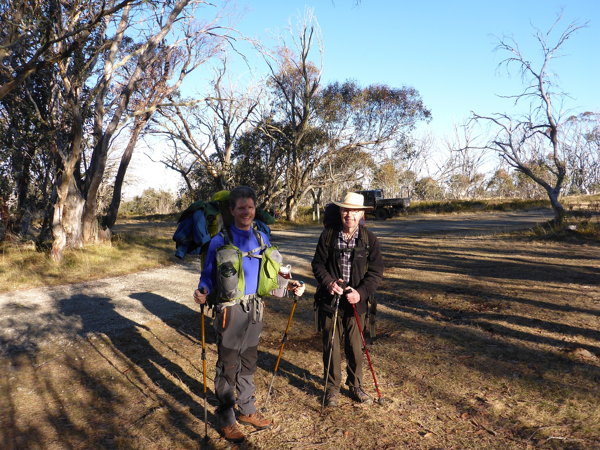
Ready to go at Howitt carpark (Photo: Allen)
We departed from Glenn’s house late on Friday morning and drove through to Howitt Carpark (2WD road all the way). From there it’s about a 1 hour hike to Macalister Springs and the Vallejo Gantner Memorial hut.
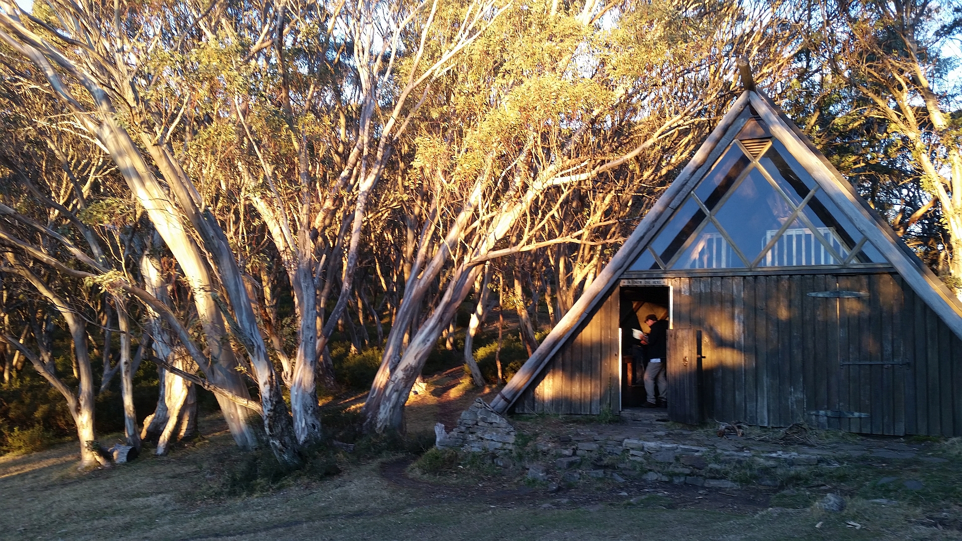
Vallejo Gantner Memorial hut at Macalister Springs
This hut is on the Victorian Heritage register as one of very few architect-designed mountain huts and is spacious and a great spot to use as a base camp as we did. While we took tents, we were lucky enough to be able to camp in the hut (which has a great mezzanine sleeping area).
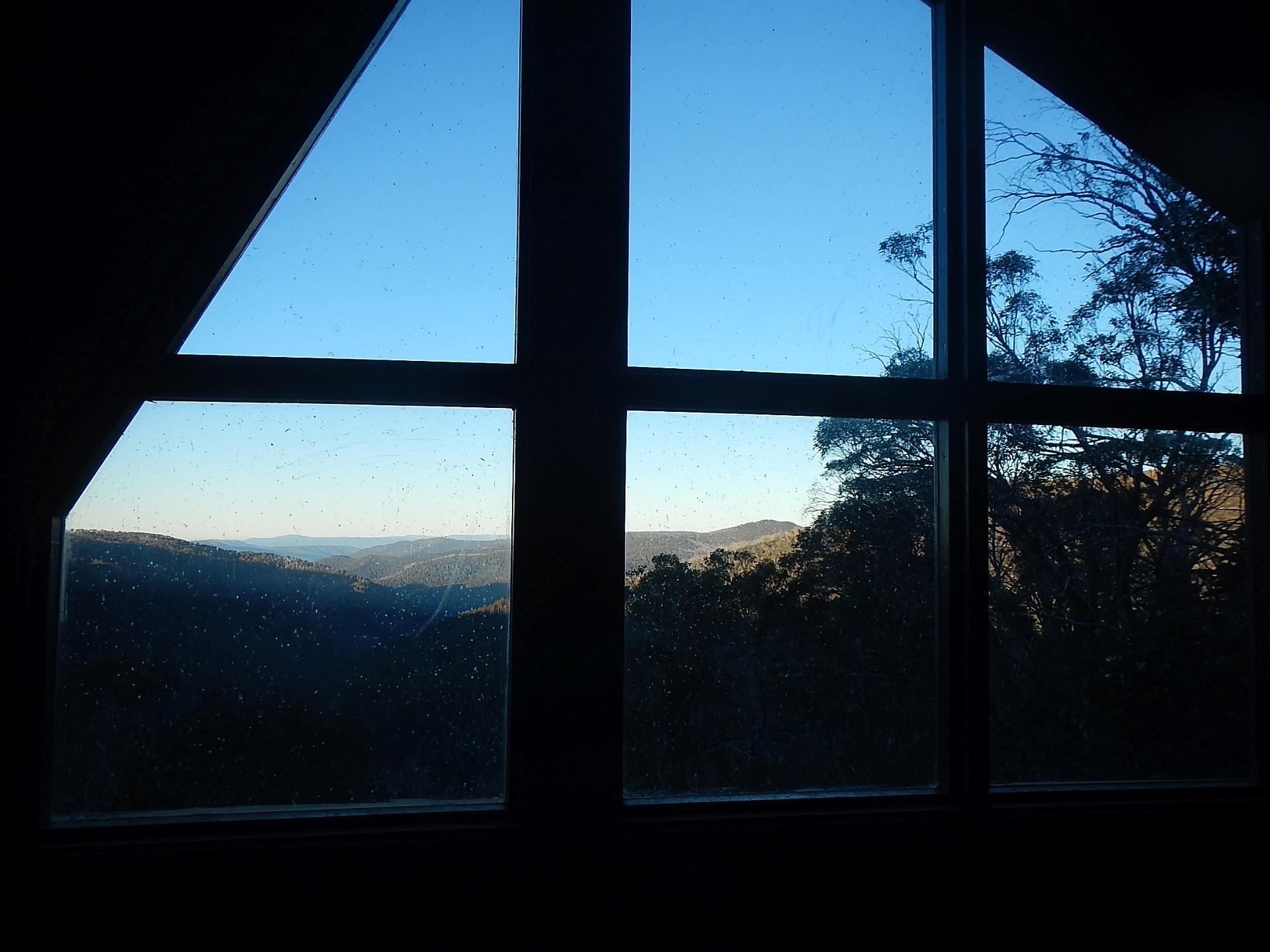
The view from the mezzanine in Vallejo Gantner hut
The hut has a fire place, large dining table and tools such as a firewood saw and hatchet to assist with collecting wood for the fire.
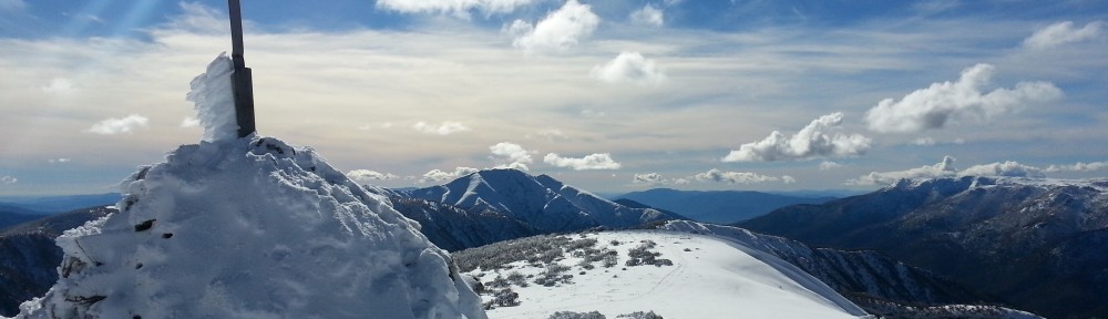
The Razor (middle right) and Mt Buffalo (in the distance) with The Viking peeking in on the far right (Photo: Allen)
We were on the trail by 8:30 Saturday morning heading for Mt Magdala (Marjorie) – VK3/VE-012. The weather was almost perfect with clear, sunny skies and a moderate wind.
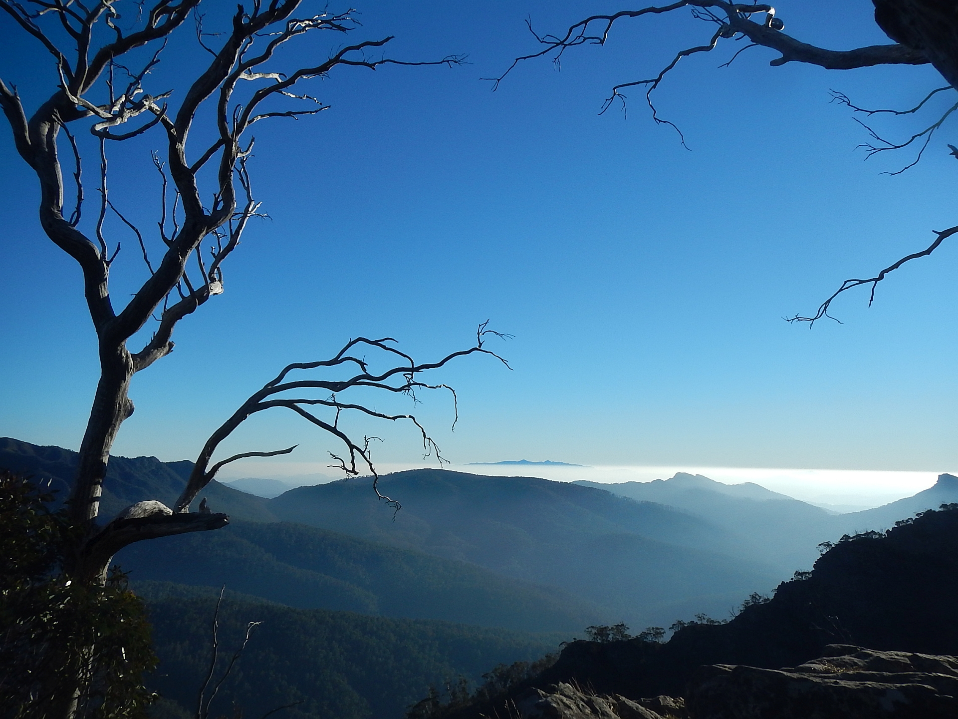
Morning mist around the Razor and The Viking (Photo: Allen)
The hike from Macalister Springs to Mt Magdala is approx 6.5km and took us about 2 hours walking time, but a bit more than 3 hours allowing for stops to enjoy the view.
Hell’s Window near Mt Magdala
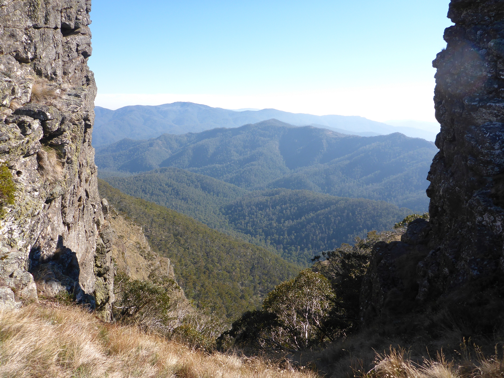
There are some spectacular views along this track, particularly Mt Howitt summit and Hell’s Window.
Operating on Mt Magdala (Photo: Glenn)
We quickly set up Allen’s EFHW antenna and spotted (good mobile coverage here from Mt Buller). It wasn’t long before we had a 9 contacts in the log with a lot of mic passing to ensure we all qualified. 40m was quite dead, but 80m was working for local contacts and 20m brought in VK6 and New Zealand.
Hellfire Creek campsite near Mt Magdala
Aware of the long walk back and the relatively short daylight, we packed up and headed back down to the saddle between Mt Magdala and Big Hill. There is a great camp site here (called Hellfire Creek campsite) where we paused for lunch. Continuing on we climbed back up to the summit of Mt Howitt (VK3/VT-001) for the second activation for the day. The wind had picked up and was quite cold, but with beanies, jumpers and good windproof layers, we were plenty warm enough for the activation.
Operating on Mt Howitt (Photo: Glenn)
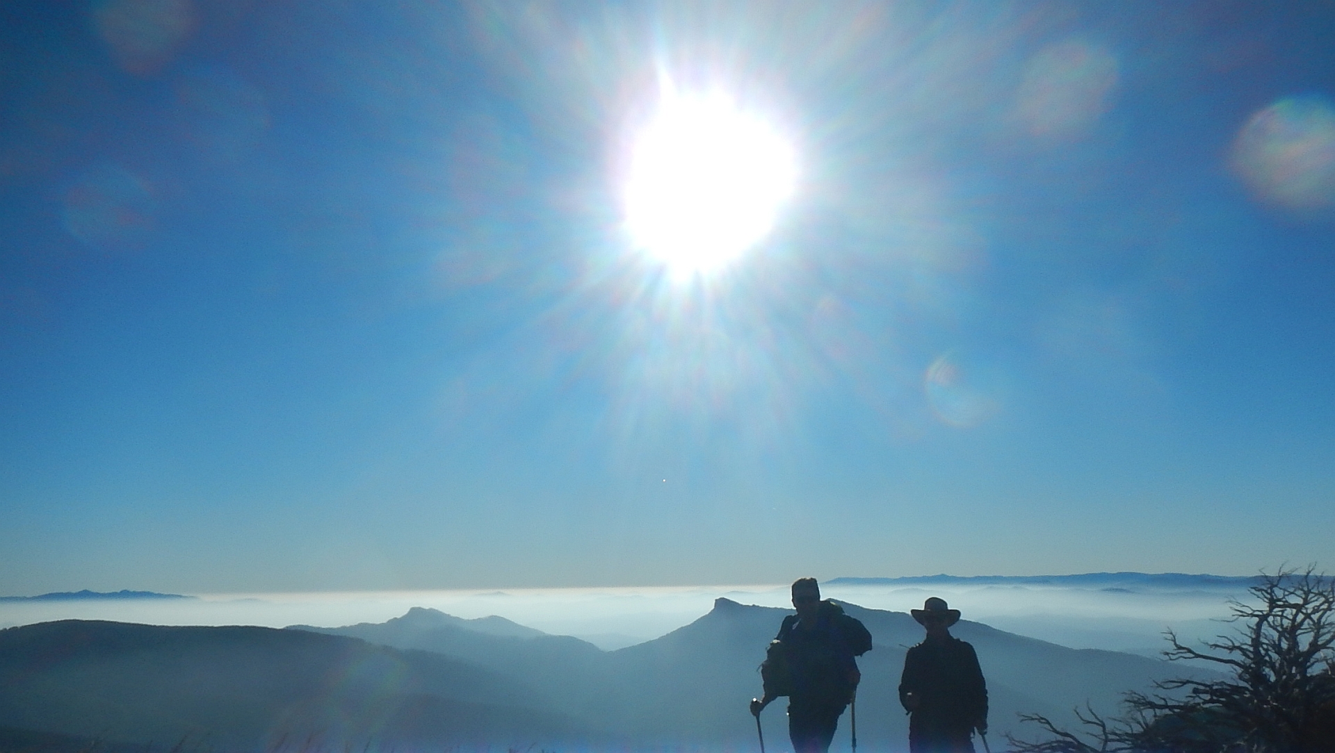
This time we set up my EFHW antenna and enjoyed a mini pileup with 21 callers. This time, 40m was alive and we had contacts from as close as Melbourne and as far away as New Zealand. 20m had a surprisingly short skip with a contacts in Victoria and South Australia.
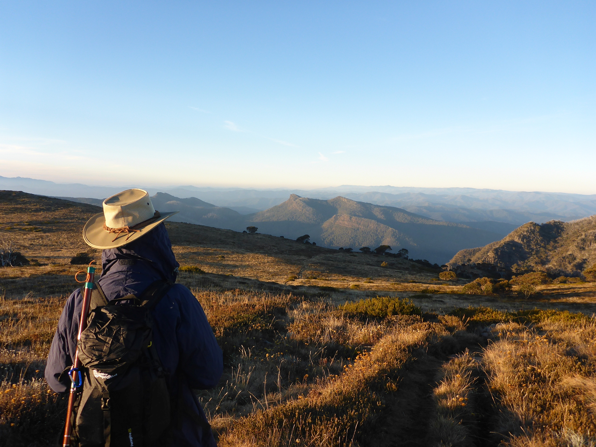
The Viking in the late afternoon sun from near Mt Howitt
We went QRT about an hour before sunset and headed back to Macalister Springs with the afternoon sun painting the mountains in warm hues. We were back at the hut just before sunset to find a couple of other hikers had already got the fire going and heated up the hut nicely.
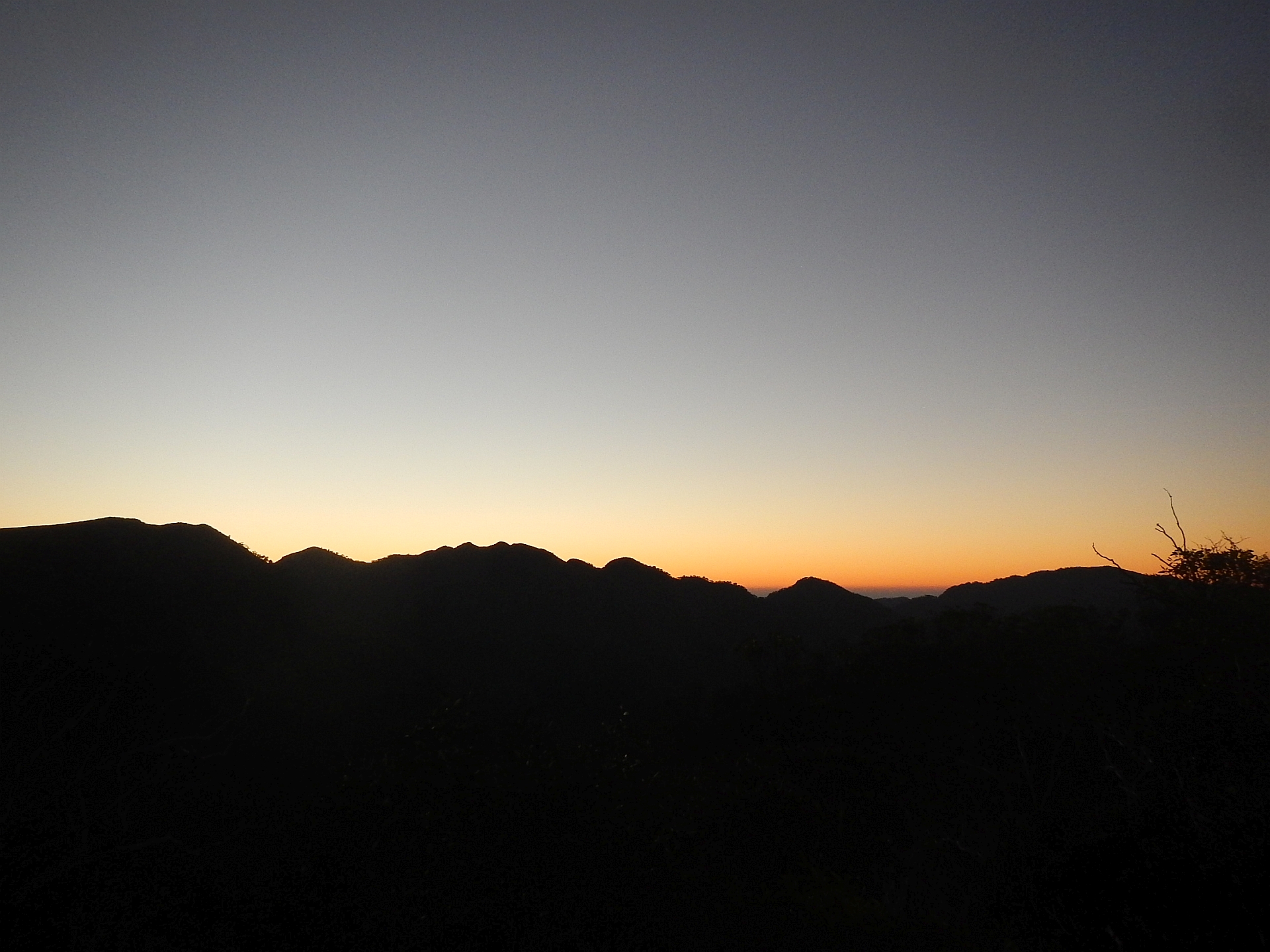
Sunset over the Crosscut Saw (Photo: Allen)
We went to bed early given the days exertions and enjoyed the view of the rising moon through the expansive glass of the mezzanine window.
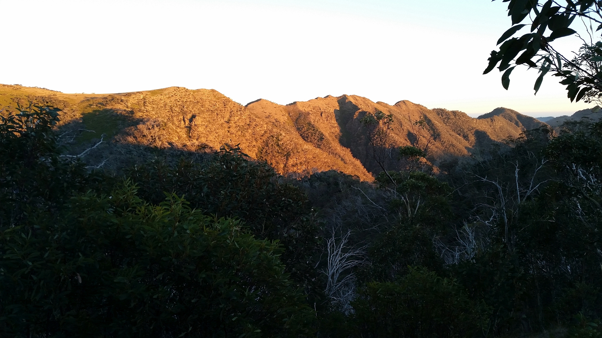
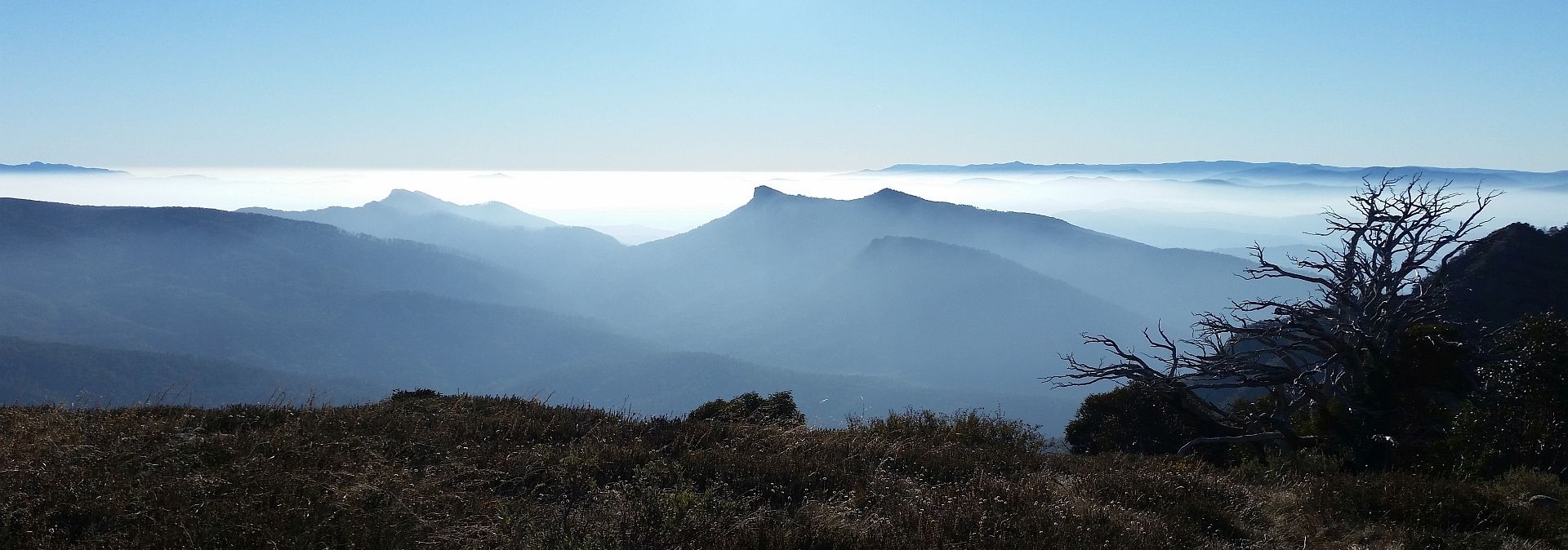
The Crosscut Saw in the morning sun (Photo: Glenn)
Sunday morning, we were up with the sun around 7am and were packed and on the trail back to the car by 8:30. Arriving at the car, we discovered that the battery had gone flat enough that it wouldn’t turn over the engine and even the lithium jump starter couldn’t get it going. I think this was primarily due to the cold soaking the batteries had overnight. After warming the jump starter for a while under my jacket and adding another LiPo battery in parallel, we got it started and we were on our way. I need to think further on reliable starting and will probably set up a paralleling arrangement to make it easy to apply multiple jump-starters as a 3.2l diesel takes quite a bit of current and the cold weather in the mountains becomes an issue easily.
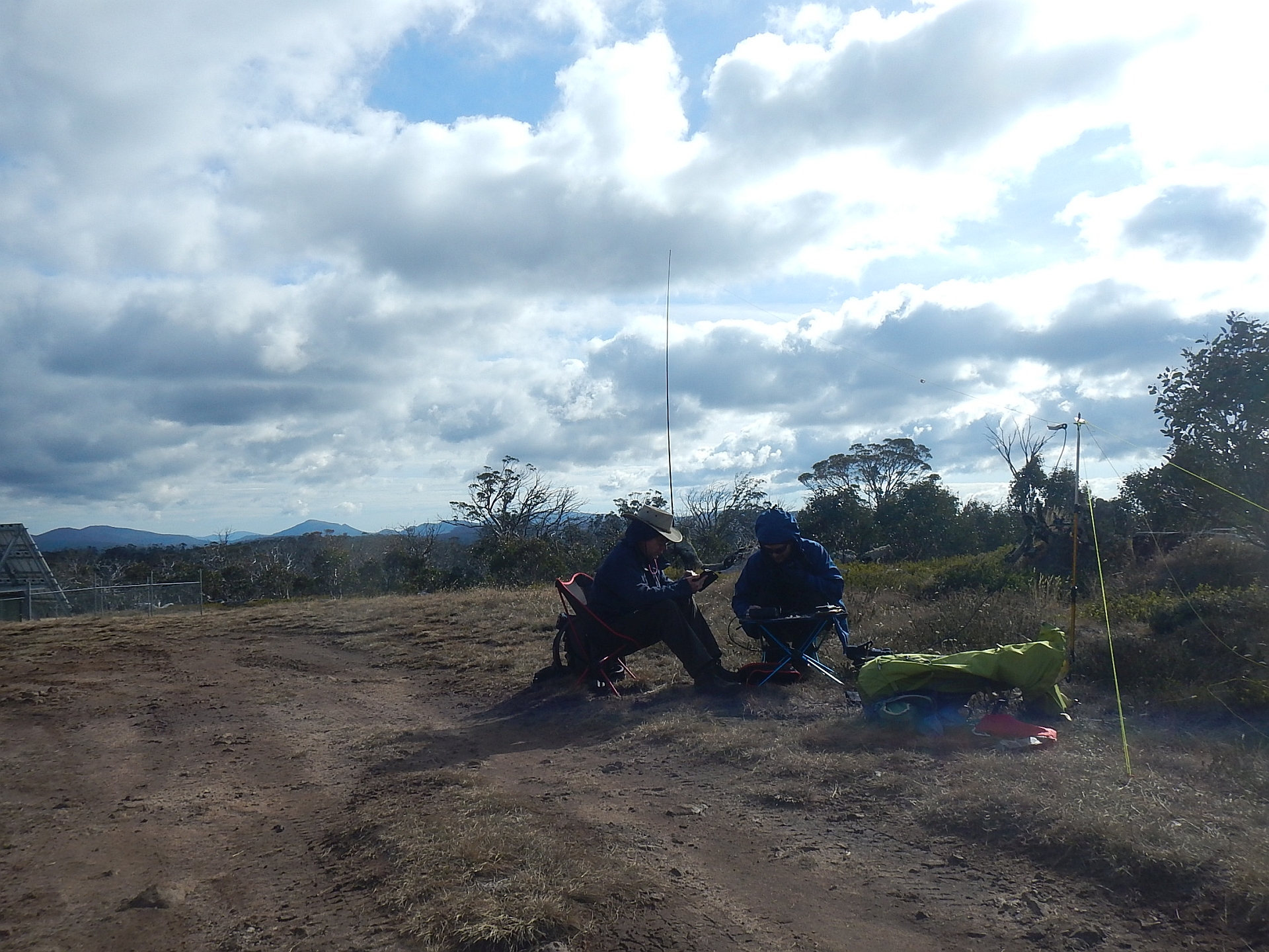
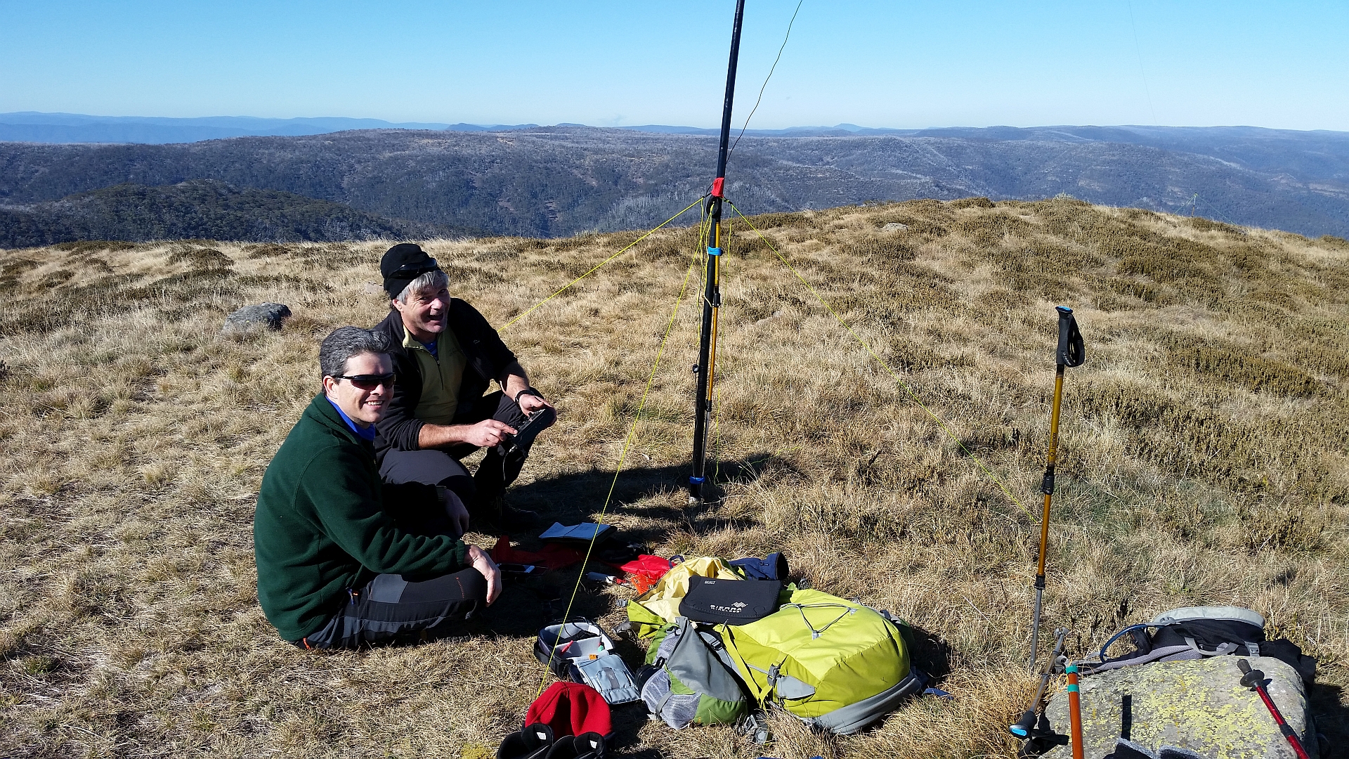
Operating at Bryces Plain (Photo: Allen)
The first summit for Sunday was Bryces Plain (VK3/VT-004), which is an easy drive-up. It’s really just the high point in a large plain. The track to the peak is 4WD, but relatively easy. There is a radio base station (not cellular) at this site, but it didn’t cause obvious problems.
We were on the air quickly and again had a good turn out of chasers (17 in total) including a S2S with VK7LTD/VK7FAMP on VK7/NE-006. While I was operating, we had a visit from a Parks ranger, who was checking on hunters in the area for compliance with regulations. Once informed that we only had radios, he quickly lost interest and left us to it.
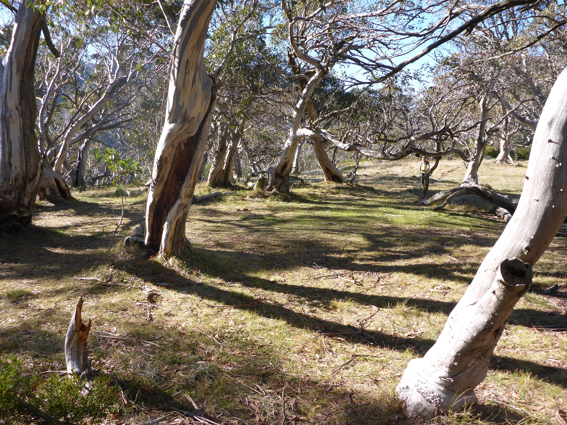
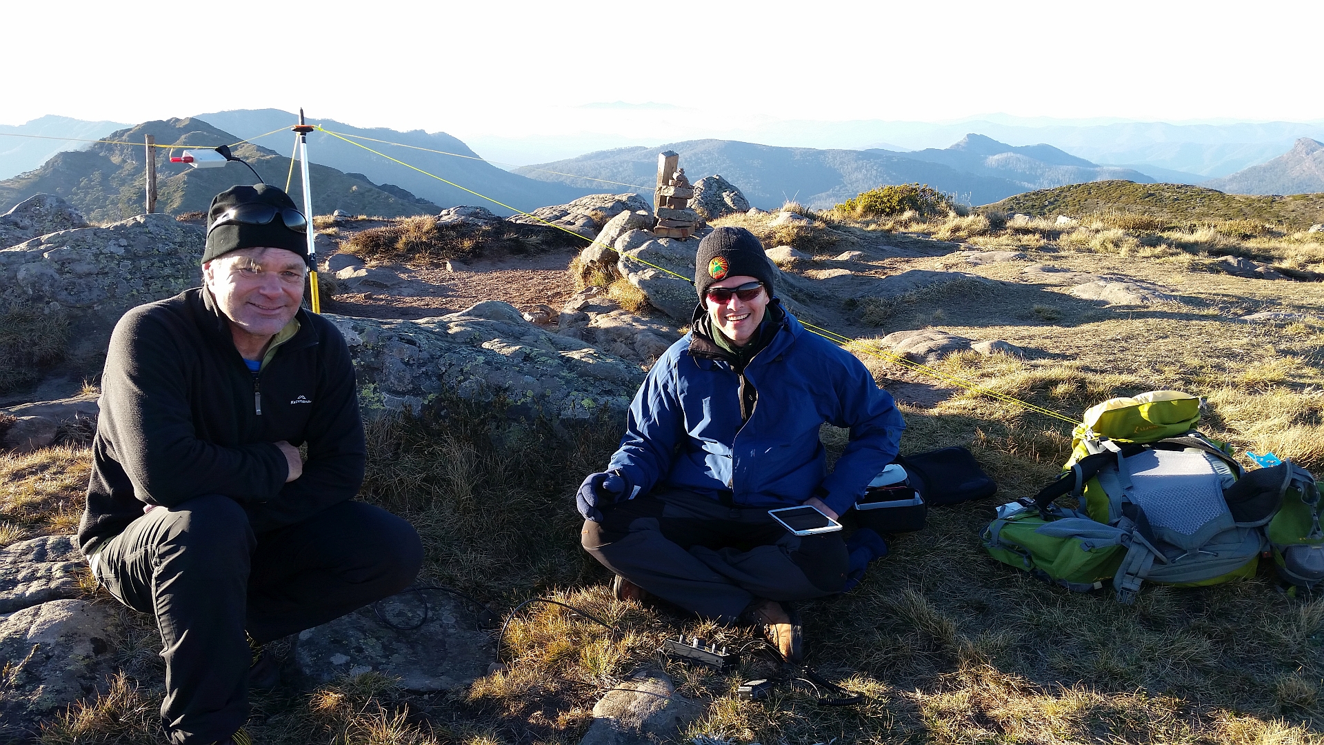
The final summit for the weekend was Mt Reynard (VK3/VT-002). This is located close to the winter closure gate on Howitt Rd, so would be possible to activate in Winter with a slightly longer walk/ski. Both Glenn and Allen had done this summit previously and had found it quite a bush bash. On Glenn’s second visit, he had found a narrow walking track and so we went hunting for this. We managed to find it and found that it went all the way to the summit plateau and with essentially no need to bush bash which was a relief. We believe this may be the route used for access to the summit plateau in winter by cross-country skiers. We’ve uploaded a GPS track to the SOTA mapping database that should help others find this track.
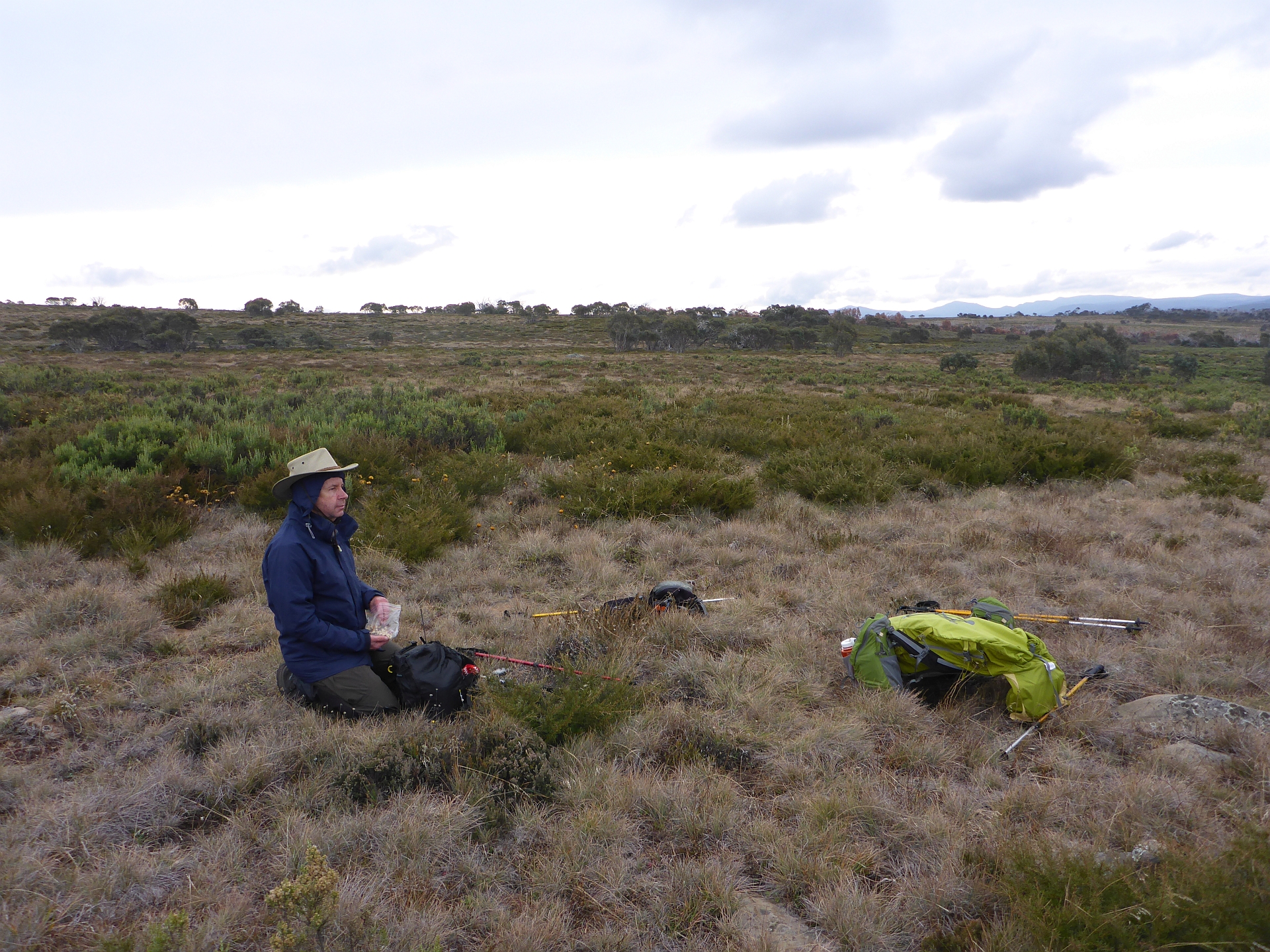
Mt Reynard plateau – everything here is above 1700m altitude
The activation zone of Mt Reynard is huge due to the plateau. Once you are on the plateau, you are in the activation zone. We decided to skip the additional 500m or so to the actual summit as there’s no better view than from the plateau.
There was a cool wind blowing and so we kept this activation short, but still had 16 chasers. Interestingly, 40m was in good shape all the way to NZ and we had 4 ZL chasers which was great.
Retracing our steps to the car, we arrived about 3:30pm. We considered activating Mt Tamboritha, but decided it would likely be dark by the time we’d finished activating it. It would also have meant a very late arrival home (particularly for Allen who had to get back to Ballarat), so we decided to call it a day and head home.
It was a really enjoyable weekend with excellent weather for the time of the year and great company – thanks Glenn and Allen.
Addendum on APRS
For this weekend we each had APRS trackers (Glenn and Allen had Yaseu HTs and I had a Sainsonic AP510). It was interesting to see how well they were being picked up. As it happened, the day before we arrived, a new digipeater was commissioned at Mt Hotham (VK3RHO-1). It turns out this is ideally located for hikes in the high country. I had many packets repeated by it from my tracker which is only putting out 1W. This digipeater will prove very useful for SOTA I think!
Even more interesting was that we all had packets repeated from Mt Ginini digipeater near Canberra – not a bad haul for 1W! I suspect this was due to a very clear inversion that was present on Saturday (which you can see in some of the photos above) helping duct signals northwards.
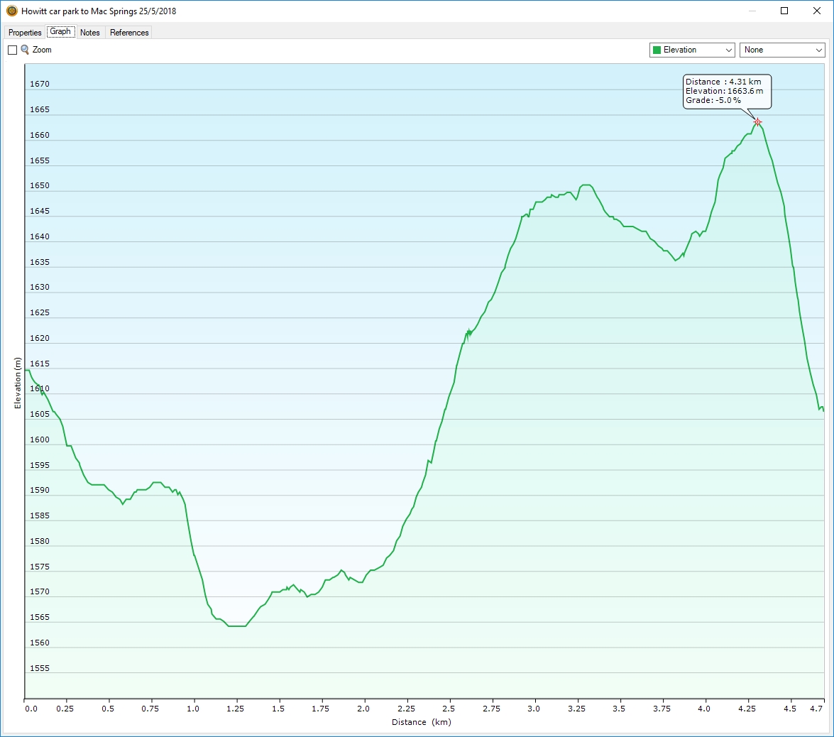
Howitt Carpark to Macalister Springs
Here are the stats and profile for the walk from Howitt carpark to Macalister Springs: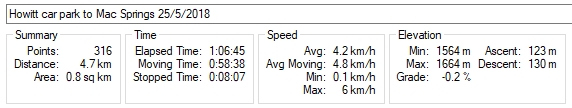
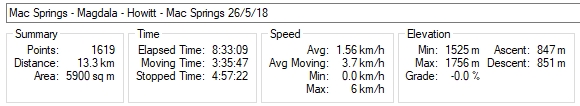
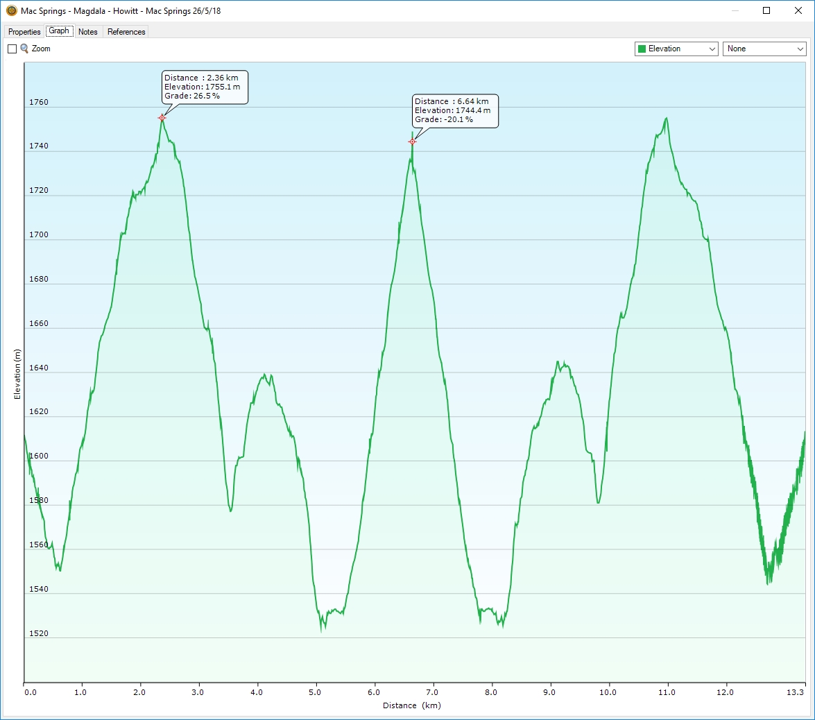
Macalister Springs – Mt Magdala – Mt Howitt return
Here are the stats for the hike out to Mt Magdala and return:
Mt Reynard access
The following map shows the track we took to Mt Reynard. The first section is through open, somewhat marshy alpine meadow and so it doesn’t matter greatly which way you proceed. There is an old bridge that used to cross Shaw Creek, which is no longer in place, but you can jump the creek fairly easily in this location (see where GPS track crosses the creek). The key point to aim for is where the track starts to enter the tree line. This is marked on the map below and the co-ordinates are as follows: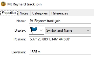
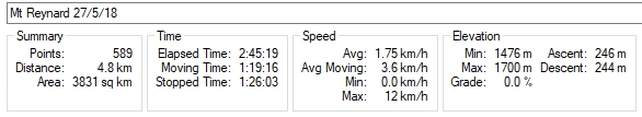
Here are the stats for the hike we did:
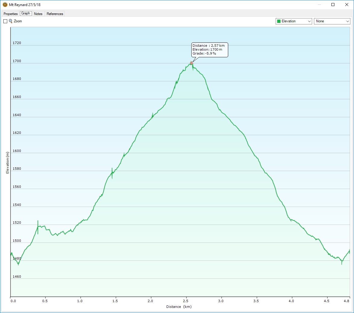
Mt Reynard elevation plot
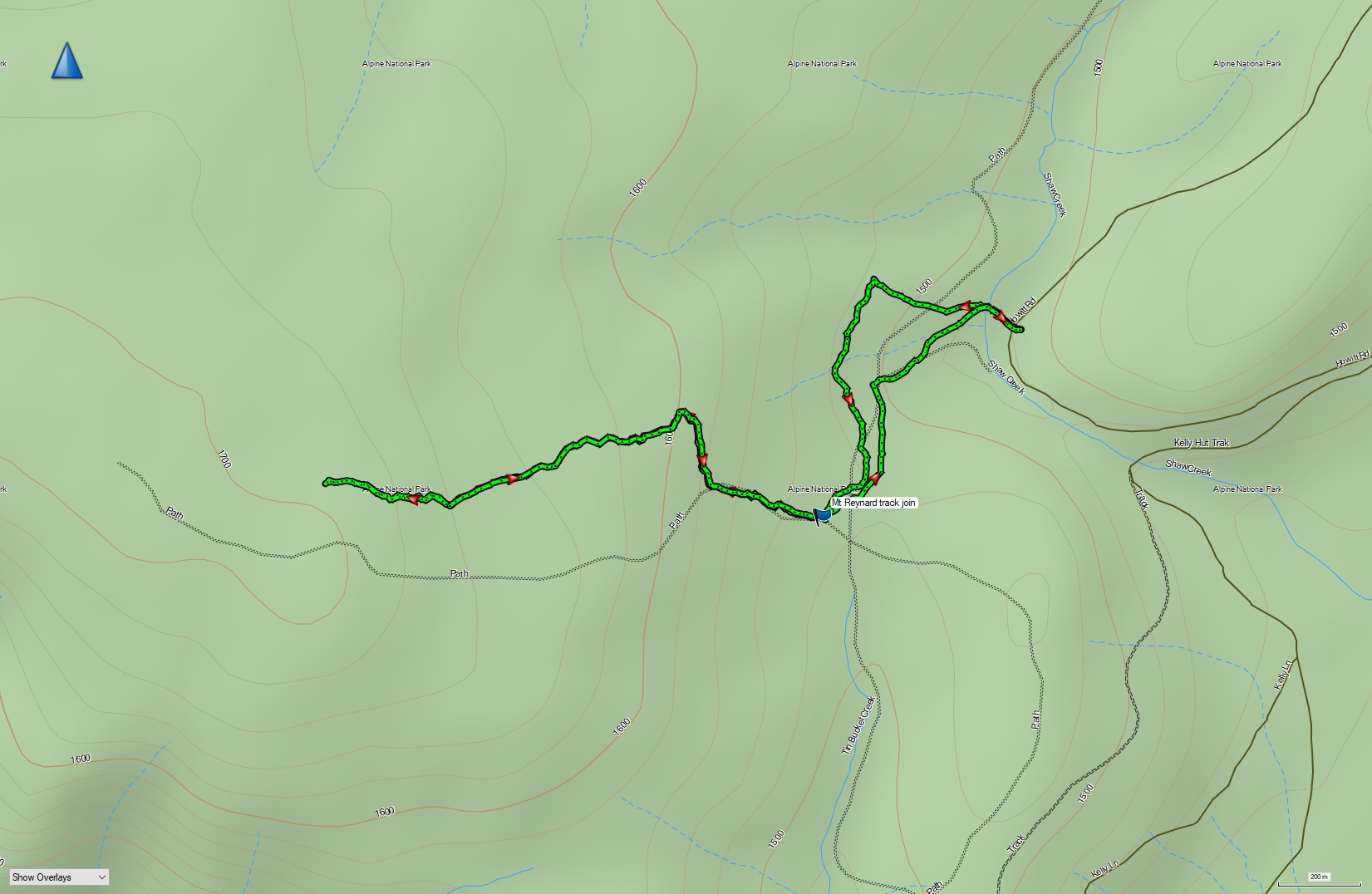
Track to Mt Reynard
What a great day to operate and make QSOs. Too bad the propagation is poor to VK but when day we will work you
Thanks John. Yes, the weather was exceptional for the time of the year. Now we want it to snow!