At the end of the Victorian Inter-schools skiing competition week at Mt Buller, I convinced my daughter that it was time to do some cross-country skiing at the neighbouring Mt Stirling resort. We packed up at Mt Buller on Sun morning and headed across to Telephone Box Junction car park on Mt Stirling. There was no sign of snow at the car park, so I had a quick chat to the ski patrollers and they said that it was at least 2km from the carpark to snow and that Mt Winstanley – the target for the day – may not have much snow at all! At that point I decided to leave the skis in the car and hike instead.
Heading off, the walking was easy up Hut trail with only a few remnants of snow amongst the undergrowth.
The top of Mt Winstanley is within the tree line and the route is well forested the whole way with Mountain Ash at lower altitudes replaced by snow gums near the summit.
The first 2.5km was mostly free from snow apart from some patches on the more southerly aspects.
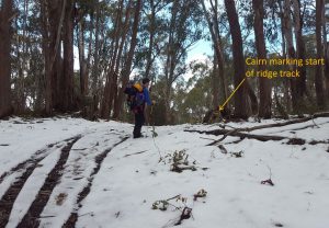 The track up the ridge line to the summit is a fairly ill-defined foot track and a little hard to find at first. With the help of Glenn VK3YY’s GPS track from his previous visit, we found the start of the track and then noticed that someone had built a small cairn on the edge of the main track to mark the start.
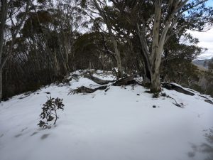
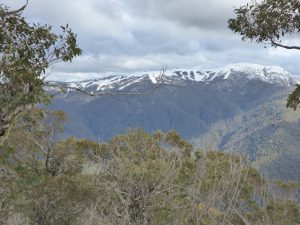
The summit is a fairly long ridge with a cairn at the far end of it. It is covered in snow gums, but has some great views between the foliage.
The conditions at the summit were very pleasant: cloudy, but clear and cool with almost no wind.
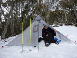
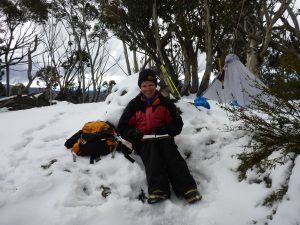
On this trip I decided to try out a new shelter option I recently acquired: a Gatewood Cape. This is a combination rain cape/pack cover and ultra-light tarp style shelter. It sets up with a single hiking pole and 6 pegs and weighs just 350g. It can be pitched at different heights depending on how much ventilation you want. The front remains above the ground and so it needs to be pitched with the rear side to the wind. It has no inner, so needs a waterproof sleeping bag and ground sheet or lightweight bivvy bag inside. It has just enough room inside for one person to sit up or stretch out. The plan was to use it to operate from within, but my daughter decided that she would like to use it while I sat outside in the snow – good thing the conditions were fine!
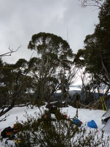
The antenna was set up as usual with my trapped EFHW supported by the quid pole fastened to a convenient tree. An alternative on this summit would be to use a throw weight to suspend the antenna from a snow gum too.
Getting on air around 1:50pm I heard Marc VK3OHM on VK3/VC-032 on 7.105MHz and managed to work him S2S. After placing a spot (there’s good mobile coverage here from nearby Mt Buller), there was a good flow of chasers including Linda VK7QP operating in the Alara contest and John ZL1BYZ on 20m easily heard.
After 20 mins, the chaser appetite was sated and I shut down and packed up as my daughter was getting bored.
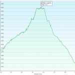
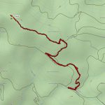
The return trip was uneventful and much quicker than the way up (52 mins vs 90 mins on the way up). Below are the trip stats for those interested in doing this summit. You will notice that the elevation graph has a significantly different starting and ending height. I think this is due to the GPS taking some time to work out its height after initial switch on (as I didn’t notice any earthquakes that would have accounted for a 70m drop in altitude!)
Another good day in the mountains!
Outbound:
Return:
I’ve also attached the Garmin .GPX track file that may be of use to anyone else as finding the track up the ridge is a little tricky: Mt Winstanley – 2 Aug 2016.gpx



Looks like a nice day out. I’ll have to add this one to the list to do one day. You have a decent range of interesting shelter options now. I have in mind to add a light weighty 1p tent to the collection.
Thanks Andrew. Yes, highly recommend having a look at the tarptent range. There’s actually a guy in Melbourne who is an agent for them and can show quite a few of the models to you.
Can’t miss that SOTA patch on your beanie!